A 1777 image of the two Sherborne Lakes
More evidence showing the lakes are earlier than 1820
In a post a few days ago I made the conjecture that the Broadwater, in Sherborne, existed before 1709 and possibly much earlier. I also showed how archive material suggested the lower lake, the Narrow-water was probably made in 1740. I now have a little more evidence to add to that post.
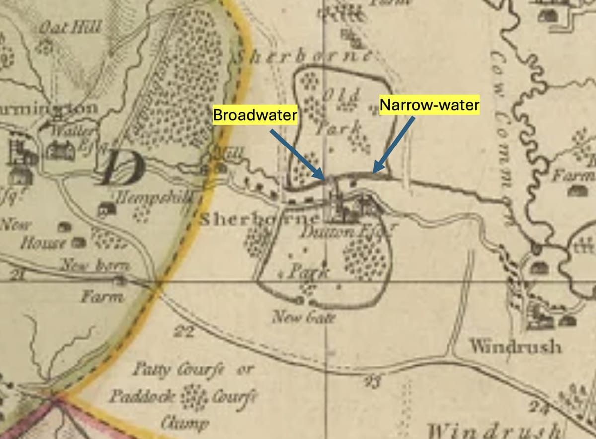
In 1777 the cartographer Isaac Taylor produced a detailed map of Gloucestershire. It’s by no means a perfect map. The image below is an extract of a small part of it covering Sherborne. I think the depiction of the lakes as the Brook runs West to East through the village is compelling. It looks like lakes to me.
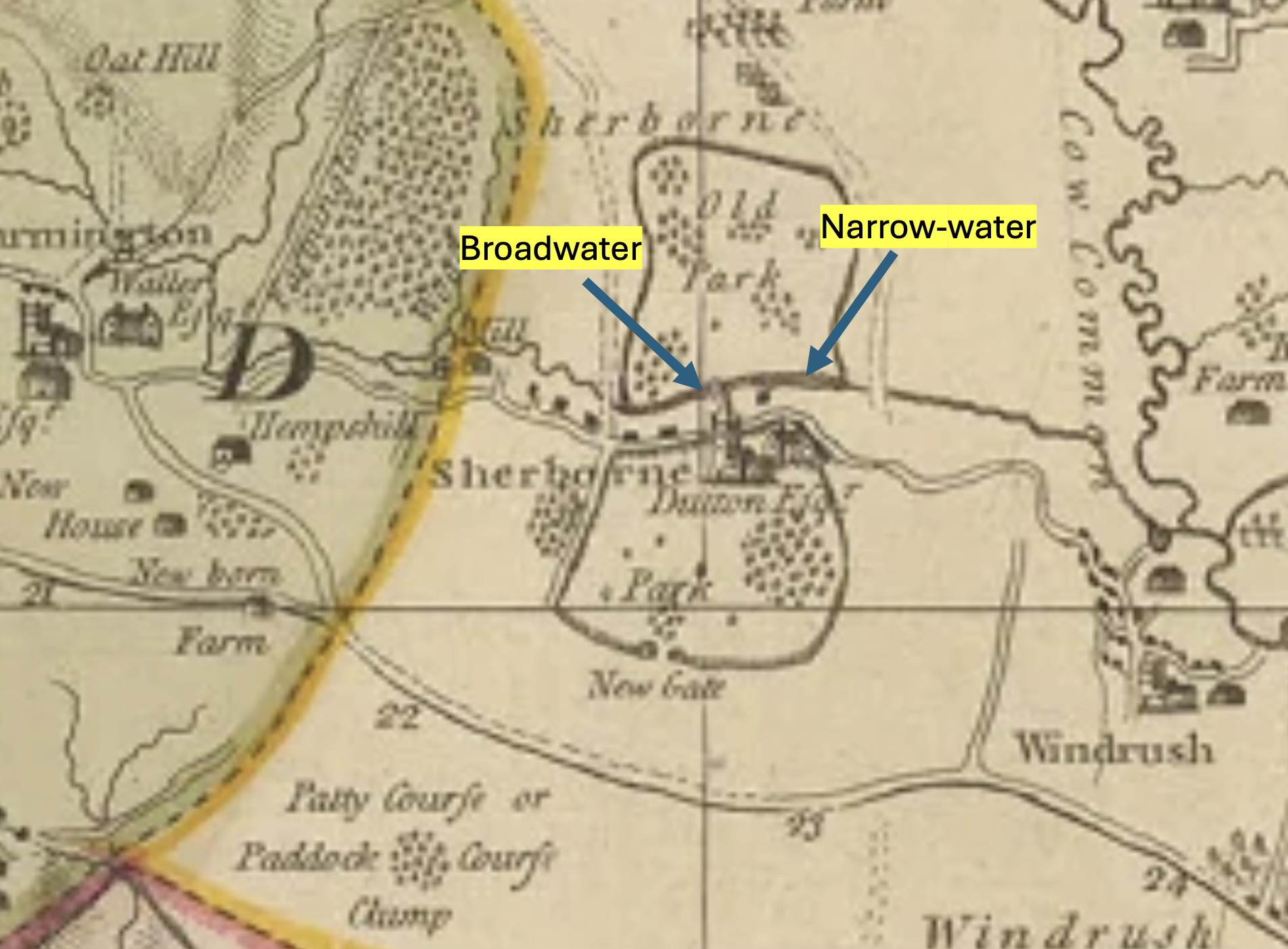
You may interpret this 1777 map as you wish. For me there is a very good indication that both the Broadwater lake and the Narrow-water lakes existed at this time (1777), and that reinforces our assessment. I should note too that Historic England in their Grade II assessment of Sherborne parkland note this map and its apparent presentation of the lake, stating “Isaac Taylor's county map of 1777 appears to show the lake”.
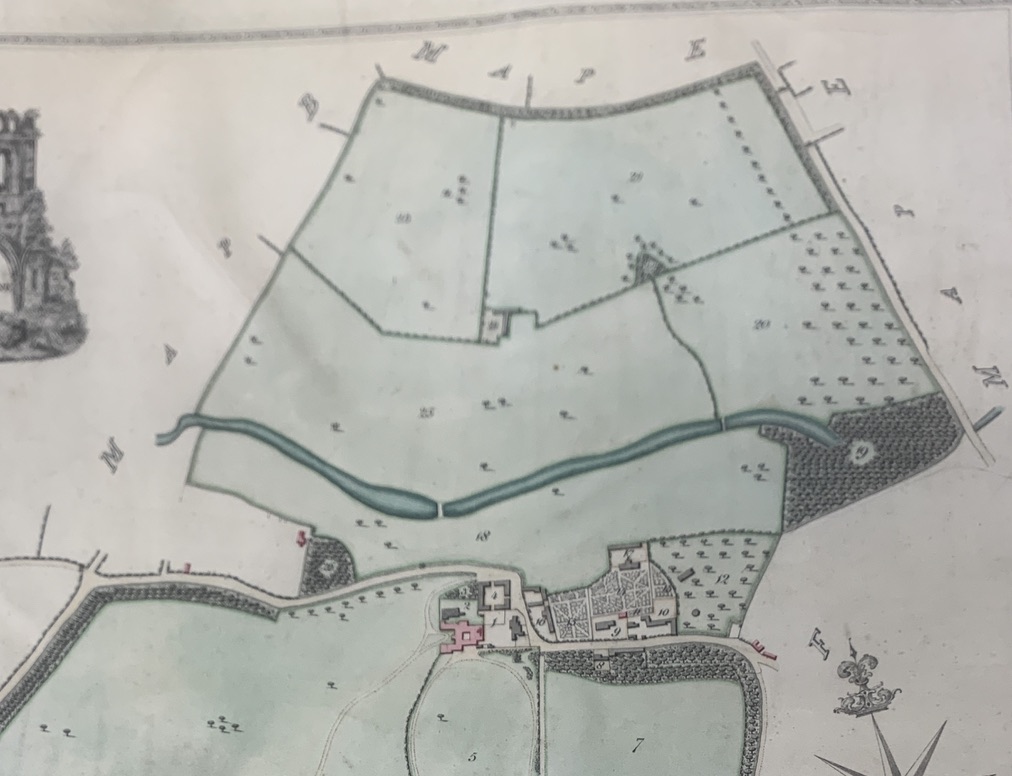
Someone resistant to this assessment might suggest that the “thickness” of the lines is the Brook together with the boundary line of Old Park, and not the lakes. But I’m confident that my assessment is correct. I really think it is hard to maintain a dogmatic view that the lakes were formed c 1820 as the NT continue to suggest. I make this challenge to their assessment respectfully and, for information, I have been saying this consistently to them for some time. As a reminder here’s the c1820 estate map showing both lakes. No mill appears downstream on any map, and no millers other than those at the mill by Haycroft are mentioned in any census in the 19th C. The first Ordnance Survey map of this area was done in 1827/1828, not 1805 as has been claimed. You can check this by looking for Home Farm (absent in the 1820 plan, built in the early 1820s, and present in the OS map. Also the road past Serena’s dairy farm doesn’t exist in 1829 but is there on the first OS map.
Now a couple of other follow ups:
- Tim’s butterfly check list has inspired a number of you to get out and about. Matt and Laura from Sandy Hill Farm are pleased to report seeing Comma butterflies, and much more importantly a Purple Emperor. Here’s an image - Britains second largest butterfly and quite rare. What a wonderful creature.

- Finally a quick mention of a couple of wildflower issues:
- Thank you to our Parish Councillors, two of whom were recently carefully scything stretches of the verges at the triangle to improve visibility for vehicles.
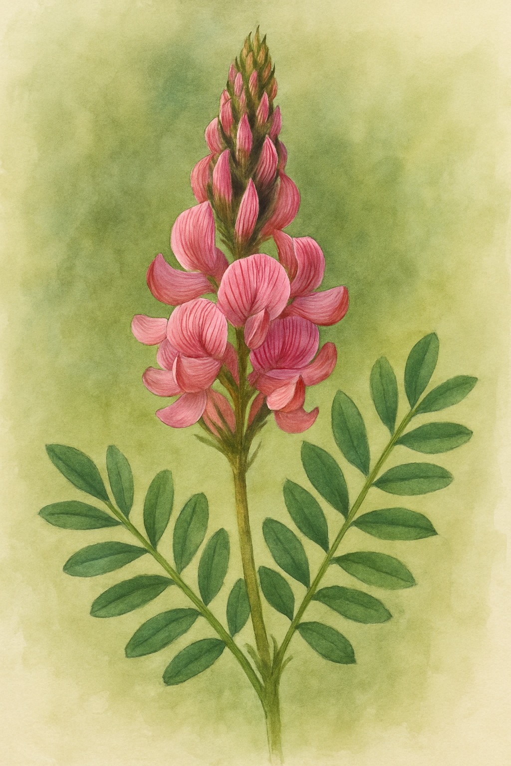
- Our recent investigation of Sainfoin as a herb gets bigger - talking to our friends down the valley, they tell me it is currently grown as a crop in Barrington Park, and much valued.