An Important Map
The last Lord Sherborne's important souvenir of a wartime flight into battle
This post, is at a bit of a tangent from my usual stuff on nature or landscape history. I have been helping out the Sherborne Archives sort through some material, a box of maps once associated with the Sherborne estate. As you all know by know, I love a map, and the gents who run the archive know I have a military background (long ago) and some of the maps appeared to have military connections. So I went through the documents carefully. One of the maps in the collection appears to be quite remarkable and this is its story.
The map once belonged to Charles Dutton, the “last” Lord Sherborne. Despite the loss of an arm as a child due to a congenital birth defect, Charles Dutton, 7th Baron Sherborne, served his country in the Second World War as a one-armed ferry pilot for the Air Transport Auxiliary. This organisation delivered aircraft of all sorts, all over the country to its end users. So Lord Sherborne would have qualified on many types of aircraft and been familiar with many RAF bases across the country, part of an essential organisation enabling others to fight. Hard work, varied and challenging with minimal time to become familiar with complex aircraft. Importantly, both his wife Joan and his brother George were also ATA pilots.
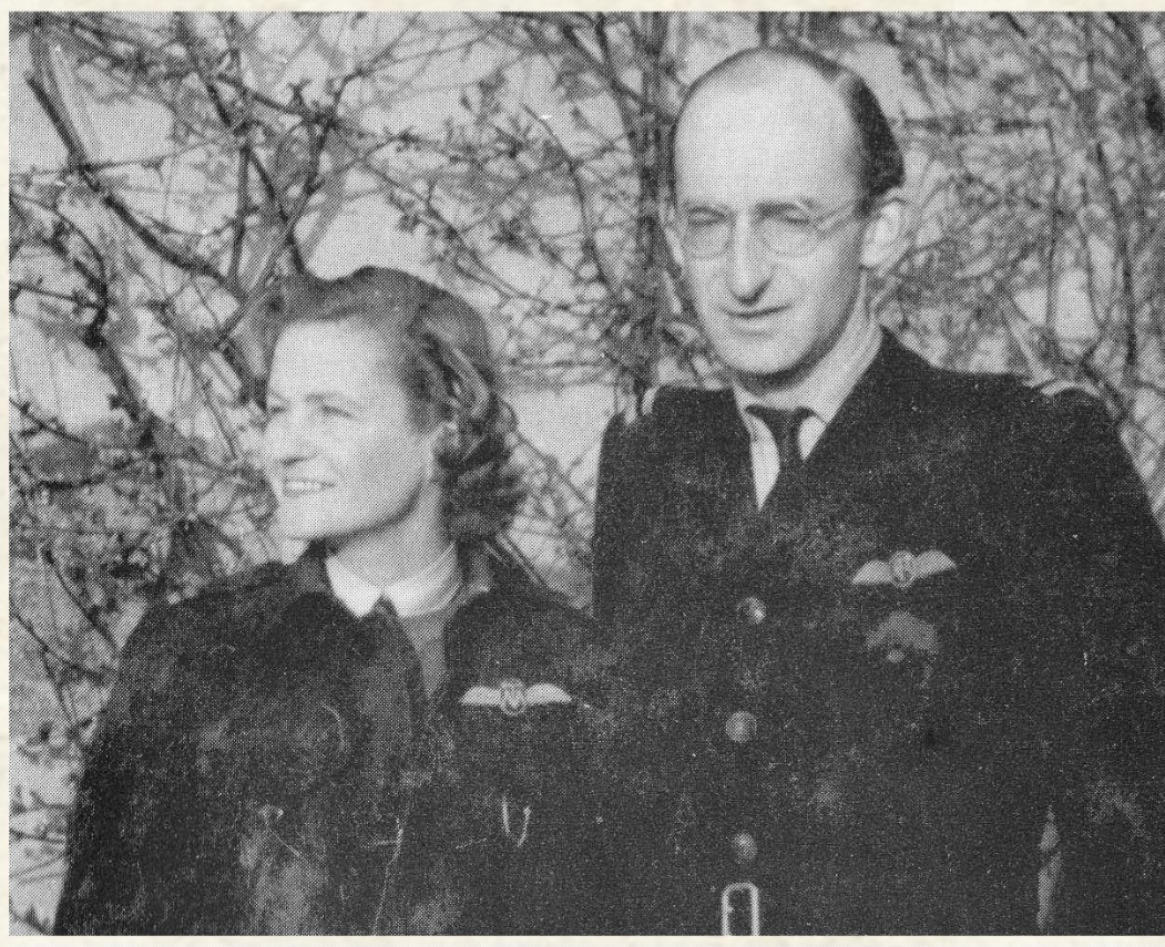
Charles Dutton, 7th Earl Sherborne and his wife Joan, both in the uniform of the ATA, both with pilots wings. Both have the rank badges of “First Officer”
It’s worth explaining the role of the ATA. This was no cushy number. One in ten ATA pilots did not survive the war - 174 died. Their activity was constant, delivering aircraft as they ran off various production lines or delivered from the US to operational units, usually singlehandedly. They were shuttled around the country in Avro Ansons, picked up aircraft from one point, flew it to the next, were returned by the Anson taxi and repeat, several times a day. At the end of the day or if weather interrupted , they hopped on a train to return to base. Then started again the next day. A very intensive, constant operation which delivered thousands upon thousands of aircraft - over 300,000 sorties. They had to be familiar with all sorts of aircraft from single engine fighters to four engined bombers, usually flying singlehandedly. There was little training, just a booklet with key notes for each aircraft type. They were brave and committed. The ATA drew its staff from those not able to fly in combat - Lord Sherborne wasn’t the only limbless pilot. A unique feature of the ATA was that physical disabilities were ignored if the pilot could do the job – thus, there were one-armed, one-legged, short-sighted and one-eyed pilots, humorously referred to as "Ancient and Tattered Airmen" (ATA). Female ATA pilots like Joan were nicknamed “Attagirls”. Interestingly, the ATA was one of the first government organisations in the world to pay females the same rate as males, at the vanguard of feminism. You can read more about the ATA at this link.
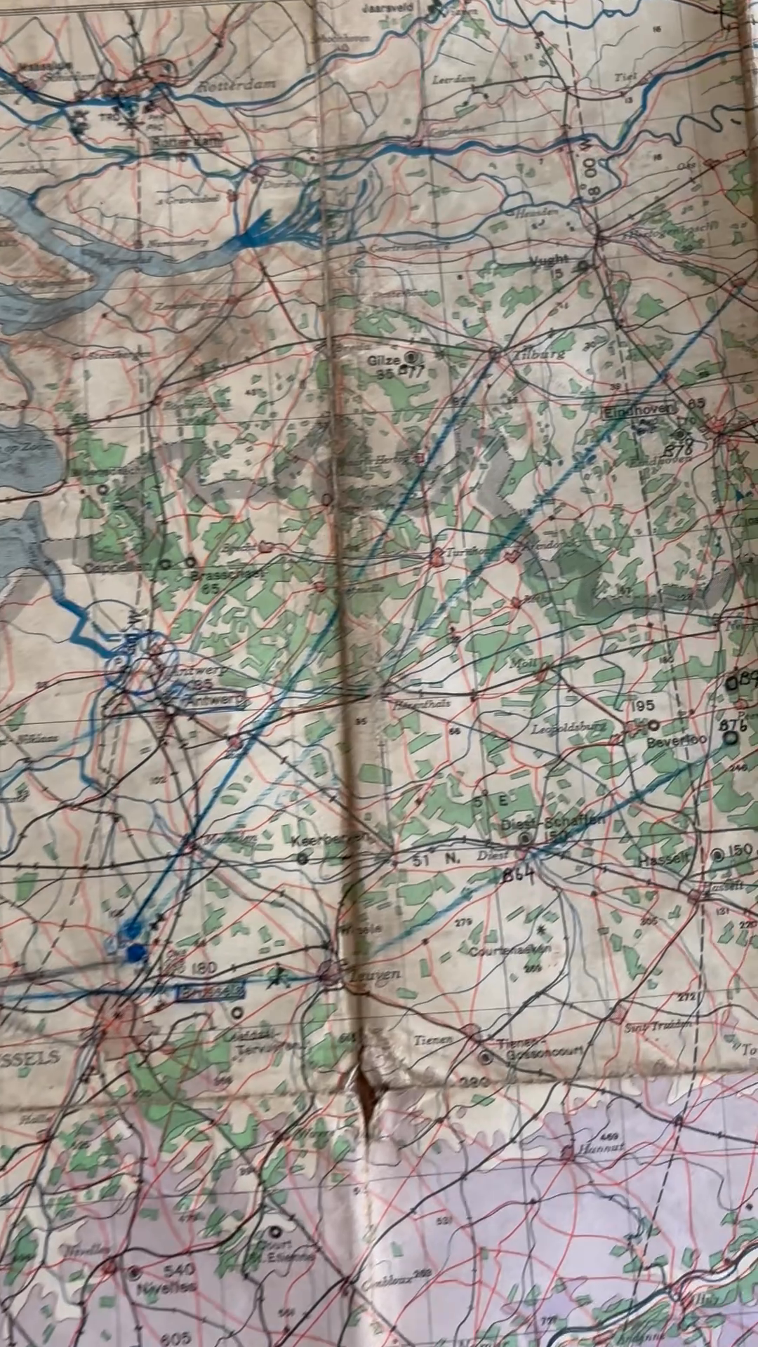
Anyway, this used flying map was found amongst a small number of others, in estate documents that were in the possession of Lord Sherborne. I would have ignored it perhaps but my eye was caught by the word “Arnhem” in the very top corner and the blue line below that terminates near Nijmegen. After some research, I believe it is likely that this map was obtained by Lord Sherborne as a “souvenir” - perhaps found in an aircraft he ferried or given to him by a friendly pilot as he delivered an aircraft to an operational unit. Its significance is that it shows, clearly, in a blue crayon a flight plan from the West of England to an area immediately to the SE of Nijmegen in Holland. Play the video again. This very point was the “drop zone” for 505 Parachute Infantry Regiment, part of the US 82nd Airborne Division. On the 17th September 1944, the Division, under command of Brigadier General Jim Gavin, dropped here as a key part of Operation Market Garden. I’m not suggesting Lord Sherborne flew the flight, that wasn’t his role, but as a pilot if he came across this map in late 1944, perhaps stuffed beside the pilot’s seat of a C-47 he was tasked with moving from one base to another, he would have known its historical importance. That’s guesswork in 2025, but I think a reasonable guess.
The drop zones south of Nijmegen, for the various sub-units of 82nd Airborne Division.
So this map in the video above flew into Holland that day, and over German held territory probably in a Douglas C-47 “Dakota” of the US Army Air Force or the British RAF. Its pilot ( US or British, could be either,) folded the map on his knee and followed the blue lines he had drawn on it earlier. It was a daylight drop (unlike D-Day) so he could look down and see the towns marked as turning points, one of a huge sky convoy of aircraft heading into battle, a bridge too far.
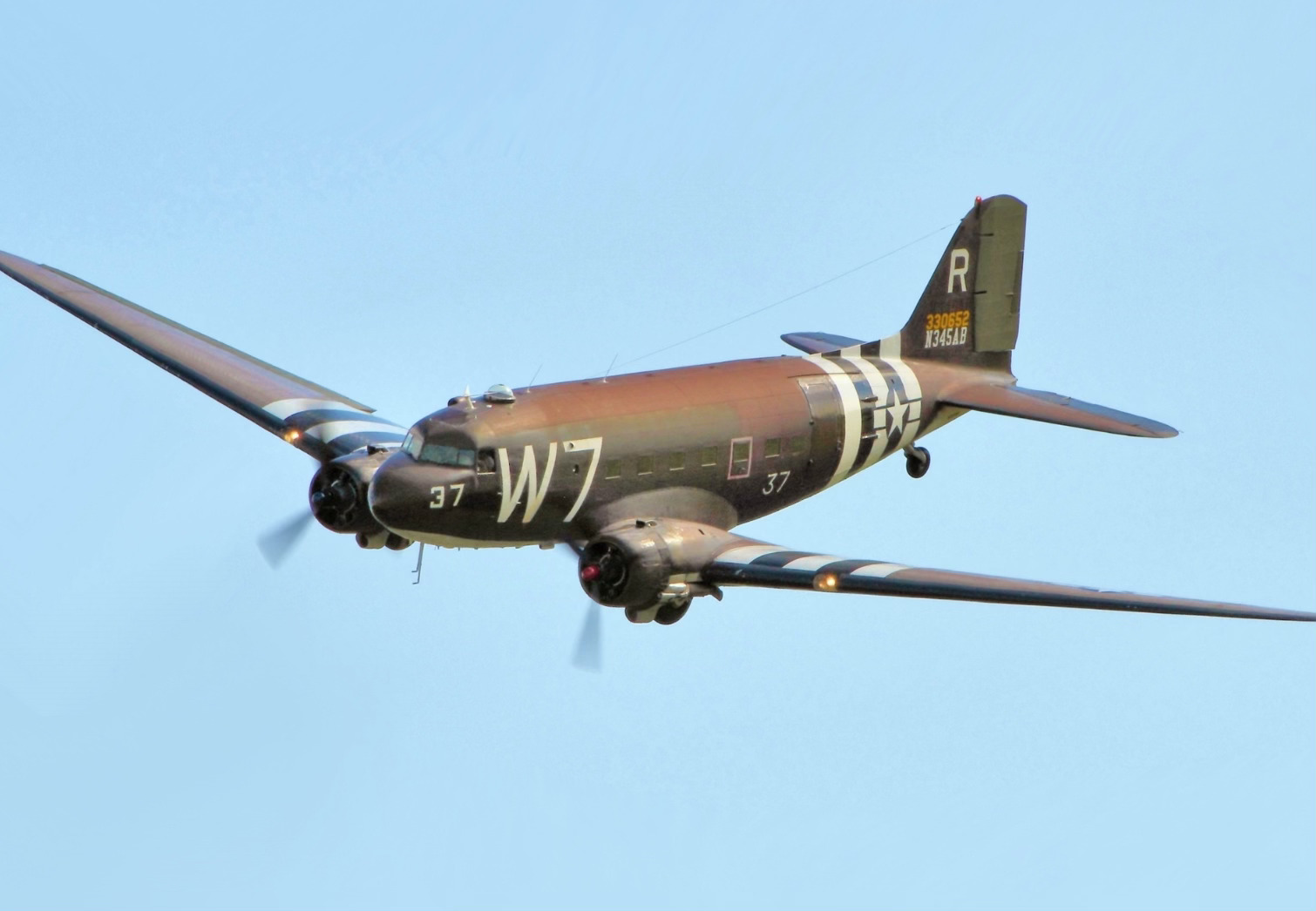
A Douglas C-47. This aircraft was called a Dakota by the RAF. It was this type of aircraft (either USAAF or RAF) that dropped the 505 PIR.
In a second link to Sherborne, locals here in the village remember a huge air armada forming over Sherborne that morning as the massive air convoy “formed up” prior to heading East. Imagine the engines of 500 or more aircraft thundering above Sherborne. What a sight, what a sound! Imagine looking up, knowing that the occupants of those aircraft were flying into battle somewhere in Europe. That memory too is a part of Sherborne heritage.
In the back of the plane, young men, American parachutists, sat nervously, weighed down with chutes, weapons and ammunition. Grim with expectation. Brave young men. Unlike the pilot and the map, these young men, little more than boys, didn’t make the return trip in the aircraft. They leaped from the plane, from hundreds of feet in the air and landed in a wild battle and fought fiercely. Some were killed in action, or wounded or captured.
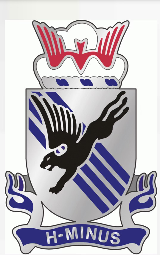
The emblem of the 505 Parachute Infantry Regiment
So may I suggest we all use this map to remember these brave young men. Remember too the service, in his own way, of Charles Dutton, his wife and his brother, who “did their bit” to help win the war, despite his disability. Remember the roar of 1000 aircraft engines circling the sky above Sherborne, and imagine what you would have felt, looking up as you came to your door to catch a glimpse. Imagine your heart beating, your chest resonating to that thunder, the thunder of war.
Only by remembering the past do we understand our place today. Our heritage gives us an understanding of where we fit in the world, and our place here in Sherborne. It grounds us, it brings us together. These aren’t personal memories, they are shared village memories, matters of history that we can respect and cherish together. They make Sherborne, Sherborne. I’d also like to highlight the work the Sherborne Archive do in this area - they deserve our thanks and support.
The map and some explanatory notes will be framed by the Brook Group and presented back to the Sherborne Archives to be used in exhibitions.
