Another Burial mound find
More ancient history and other local landscape and nature stuff.
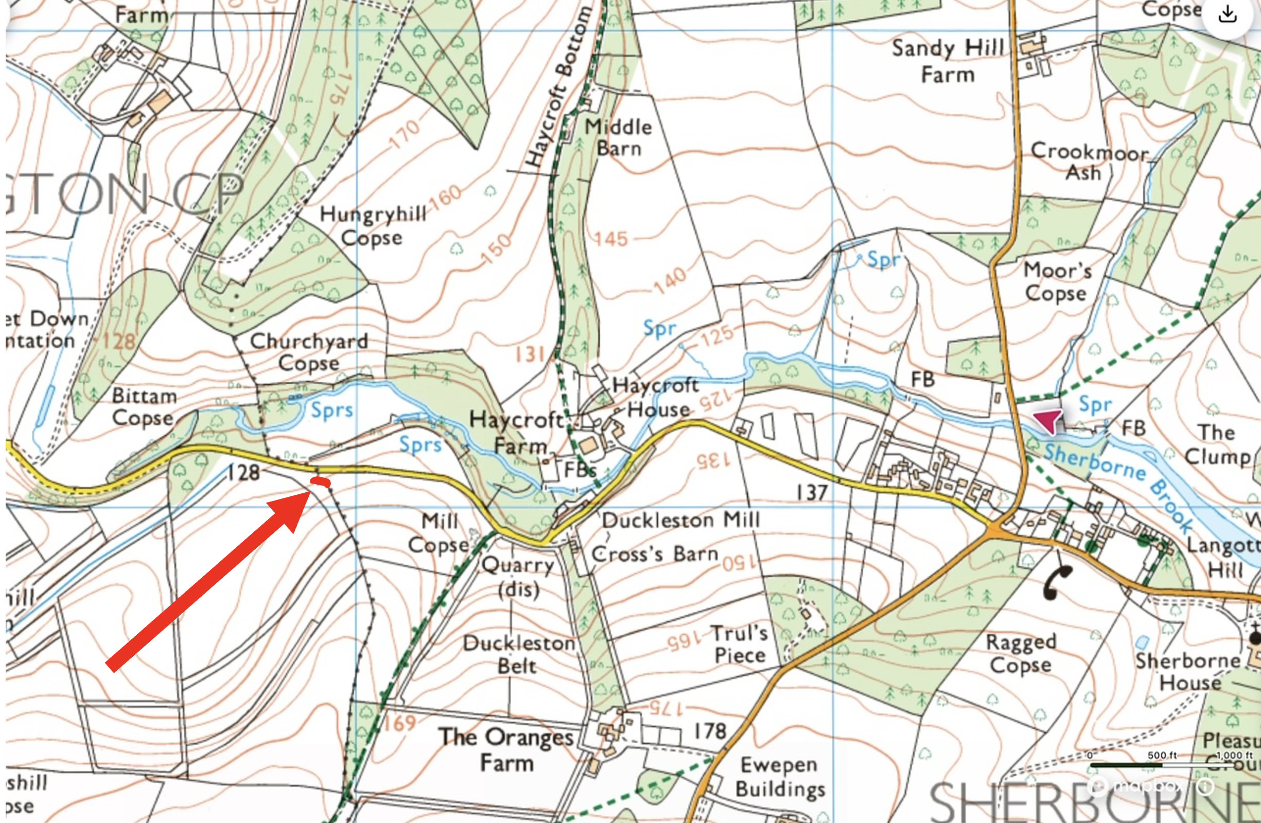
I’m sorry if my little obsession with burial mounds bores you to tears. But in dialogue with the County Archaeologist, he’s added one we have found to the Historic Environment Record (HER). This one sits perfectly visible from the road, right on the Sherborne/Farmingtonparish boundary - especially visible at the moment since its sits in a little patch of woodland and there are no leaves. Once you see it, you’ll notice it every time you drive the road. It’s marked on the map here:
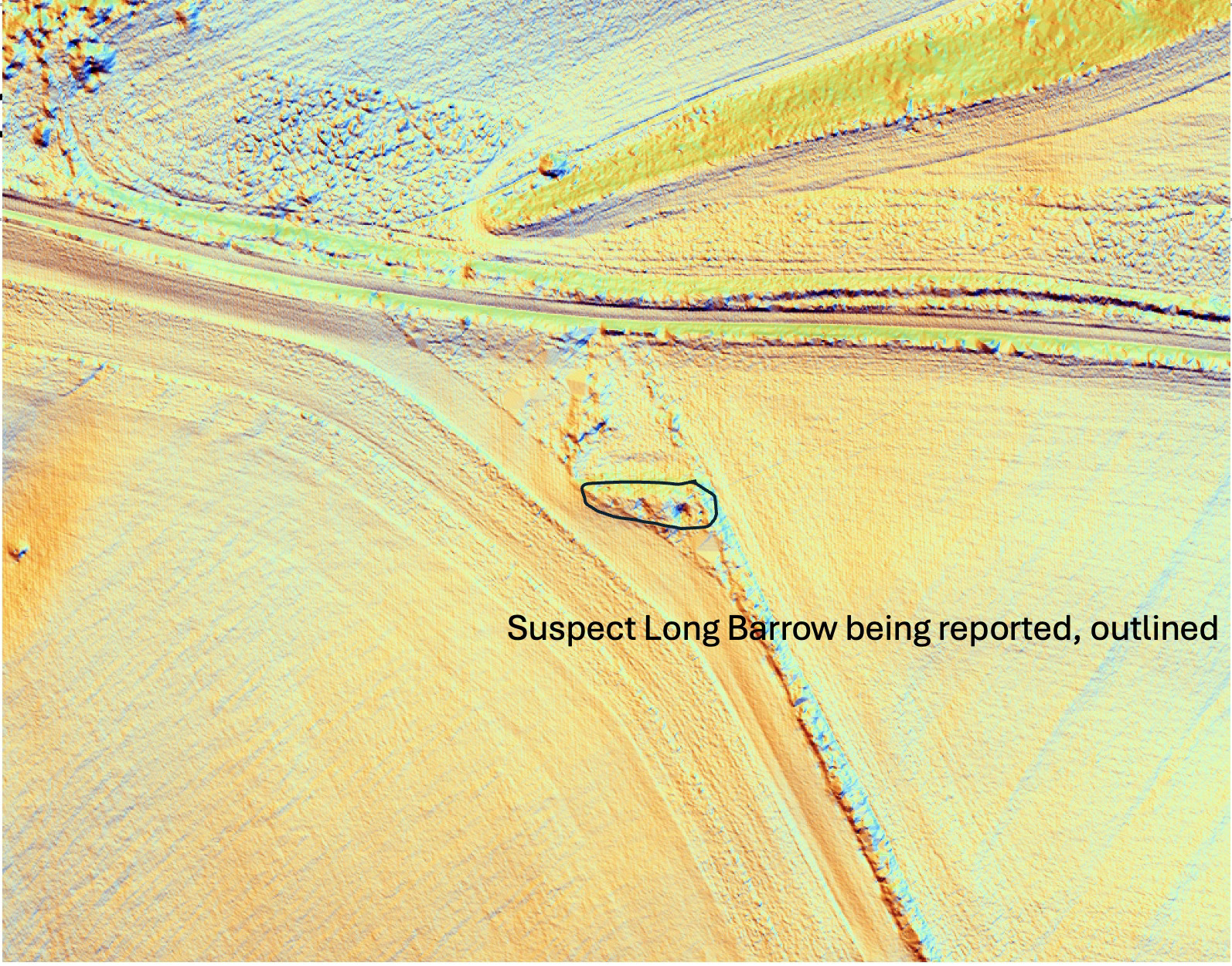
and here it is marked on a LIDAR map:
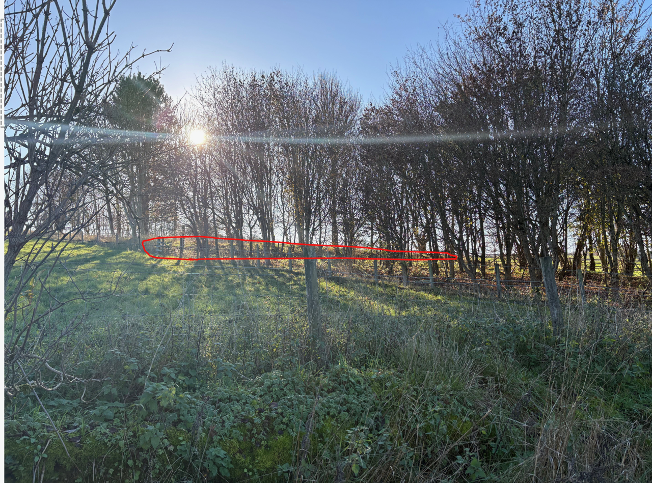
This is the view from the road - I have outlined the mound in red. I suggest a tip of your hat or a nod is appropriate as you pass, in memory of one of the first settlers in this area, our predecessor here:

These are the characteristics by which I have justified the find, and accepted by the County Archaeologist in Gloucester:
1. This appears to be a longitudinal mound about 25m long. Approximately 5m wide, 1.2 m high from a ditch to the N, 0.5m high from the field to the S . Wedge shaped. So it fits the physical characteristics of a neolithic (Stone Age) Long barrow, a burial mound typically for a chieftain and this family. It is therefore about 5000-5500 years old, one of the oldest man-made structures in the country, dating from 3000-3500 BC.
2. It is aligned E-W, which a very good proportion of Long barrows in the region are.
3. It is near an ancient path/ road. The road 30m North was once a Gloucester to London road. Many barrows lie near ancient routes.
4. The site sits on a Hundred (and parish boundary). There are other long barrows on this boundary used by Anglo-Saxon clerics as pre-existing features by which to define boundaries.
5. The site overlooks two valleys to the W (Bittam Bottom and Empshill Bottom) and one to the E, which is a normal sort of position for Long barrows.
6. It is relatively close to water (numerous springs <100m away to the N on the Sherborne Brook). Many local barrows seem associated with springs, or more likely where once neolithic settlements were built next to springs.
7.Presence of badgers utilising the mound and possibly voids within. (80% of burial mounds on Salisbury plain have badgers invasions). This one has a badgers sett dug into it and indications of voids within, I think. Badgers like these places - they can make a side entrance and utilise the spaces within.
Against all that, the site is not , as might be usual, on a crest or much of a false crest. All in all I think it’s a convincing find. I must also tell you it is on private land so not appropriate to go for a close look without the owner’s permission.
Three other things to report:
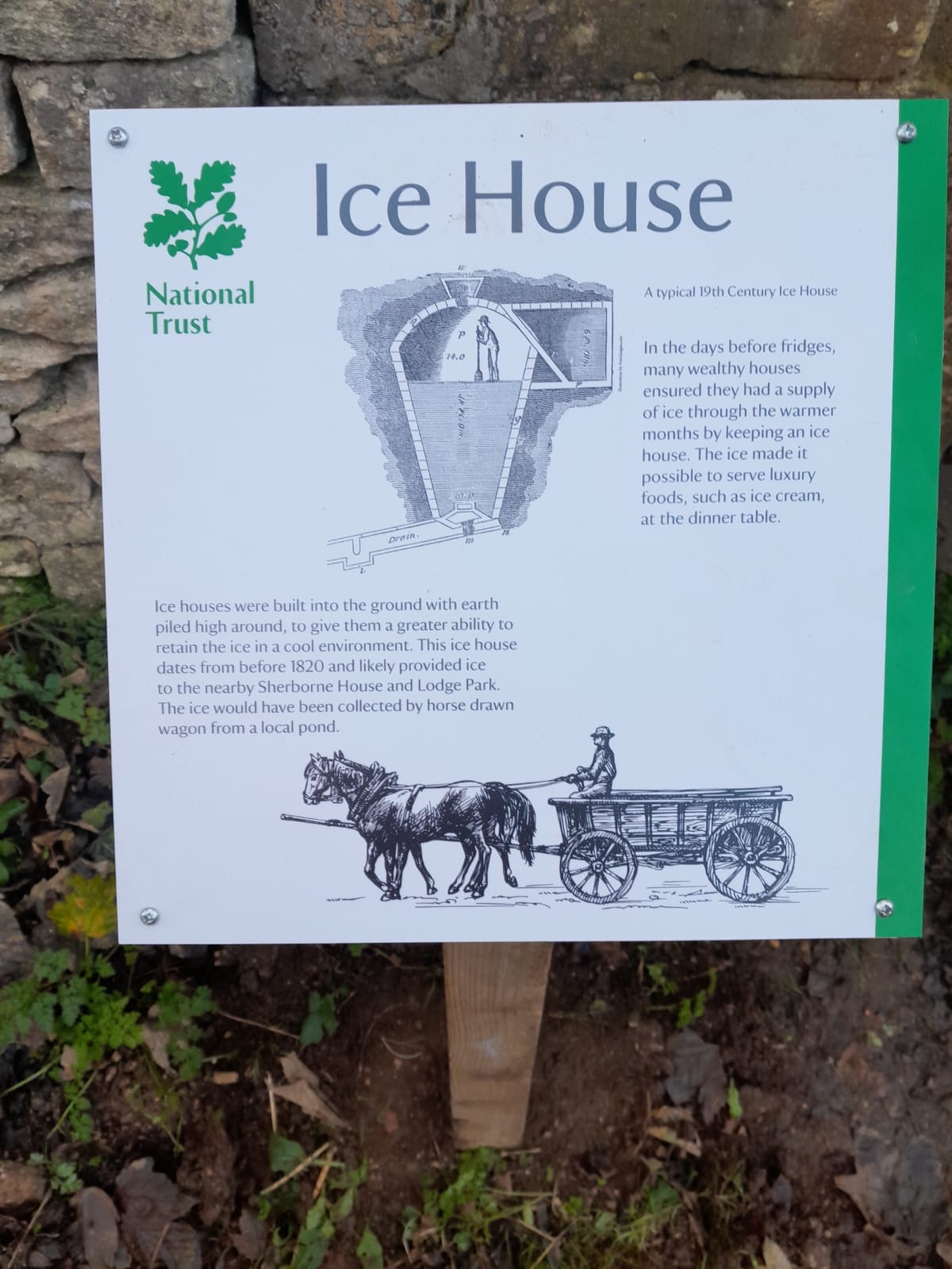
a. An explanatory sign has finally been replaced beside the “Ice House” just south of the pleasure grounds south off Sherborne House, beside the foot path. Well done the NT for getting this done eventually. The NT date this to “before 1820”. I’d be a bit less cautious - I think it might be as old as 1620- 1630 and technically a snow well. It is the same design and dimensions as “snow wells” built under the eye of Inigo Jones at Greenwich Park and Hampton Court in that period. Even the internal brickwork looks 17th C. The structure is a bit dilapidated, and has been repaired poorly over the centuries, but I think it’s important.
b. Serena reports that one of the occasionally visiting swans has taken up residence on the Narrow-water. She has named it “Patrick” in honour of the late Mr Paul. Serena admits there is a chance it’s actually “Patricia...”. We shall see.
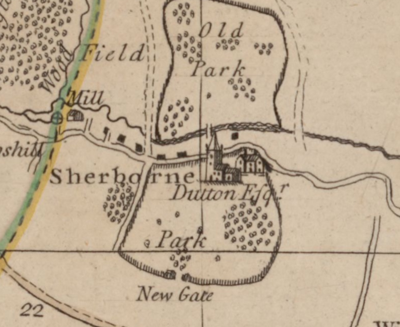
c. Talking of which , there has been discussion of late over the date of the Narrow-water. You will know by now that I take the view it is 18th C. One of the pieces of evidence for this is Isaac Taylor’s 1777 map of Gloucestershire. Until now most of the images of this map I have found have been low definition and a little open to interpretation, but this new high definition image below is , in my mind, conclusive. Both lakes present in 1777. Tell me I’m wrong.