Decoding the mysterious historical design of Lodge Park
A Gloucestershire Parkland hides thrilling secret geometric designs, astounding mathematics, and big questions still to be answered.
Last year, (before this newsletter migrated to Substack), I shared some startling discoveries about the geometric layout of Lodge Park, and since then, I've uncovered even more intriguing observations that point to remarkable mathematical skill in its design. Despite sharing my earlier findings with the National Trust, the owner of this park, I've received no response - not even a shrug! I'm not offended, just bemused by the lack of interest or inquisitiveness in what I believe could position Lodge Park as a landscape of tremendous historical importance. Never mind, I’m ploughing on.
A Work in Progress
I'm currently developing a detailed paper for publication in the coming months, as each analysis section reveals new complexities that are too extensive for a single blog post. I'm also seeking help from someone with GIS (Geographic Information System) skills to further validate these findings.
In the meantime, I'd like to share a "lite" version of my observations, invite dialogue, and highlight some fascinating recent discoveries about this unique parkland. The format of this medium doesn’t allow for perfect accuracy, but forgive me that’s not as important as it sounds, given the clear design features I’m about to show you..
Lodge Park: A Brief Introduction
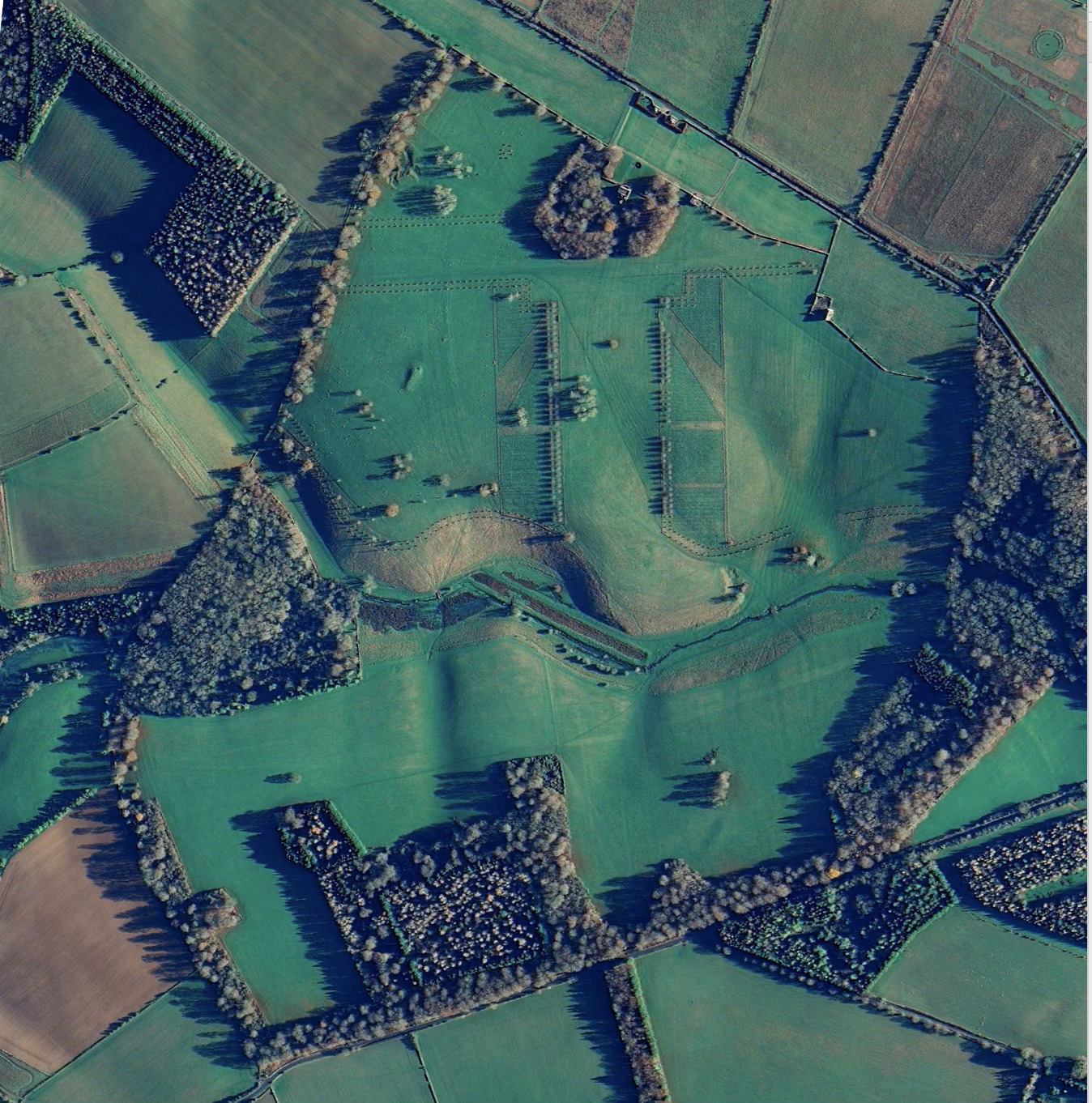
For those unfamiliar with Lodge Park, it's a picturesque landscape in Gloucestershire featuring expansive parkland initially designed in the 17th century for "Crump" Dutton by unknown designers, and later modified in the 18th century by the renowned Charles Bridgeman (though not all of Bridgeman's plans were implemented).
The park features:
- Rows of trees and strategically placed tree clusters around gently rolling meadows
- A central lime tree avenue with a perpendicular avenue creating a "T" formation
- Carefully positioned beech and chestnut clumps that frame views across the estate
- A fine "grandstand" built around 1630 (long attributed to Inigo Jones, though this is now less certain)
- Ancient archaeological features including at least one Neolithic long barrow and likely a Bronze Age round barrow
- Multiple Anglo-Saxon boundaries that cross the parkland, converging at a key viewpoint
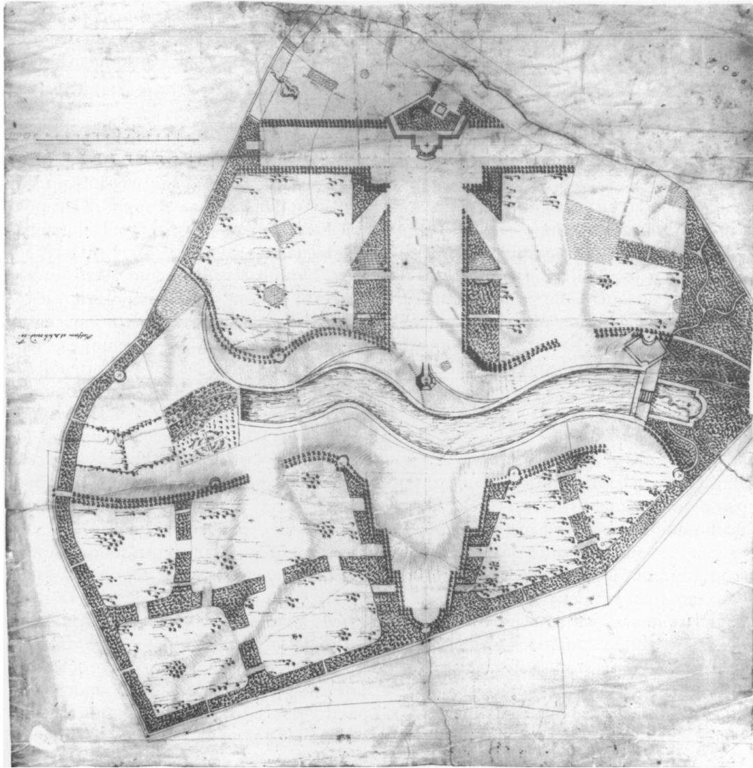
Currently, the National Trust is undertaking an ambitious tree planting program to recreate elements of Bridgeman's original design vision. Here’s a copy of Bridgeman’s plan.
Gate Alignments Reveal a Hidden Pattern
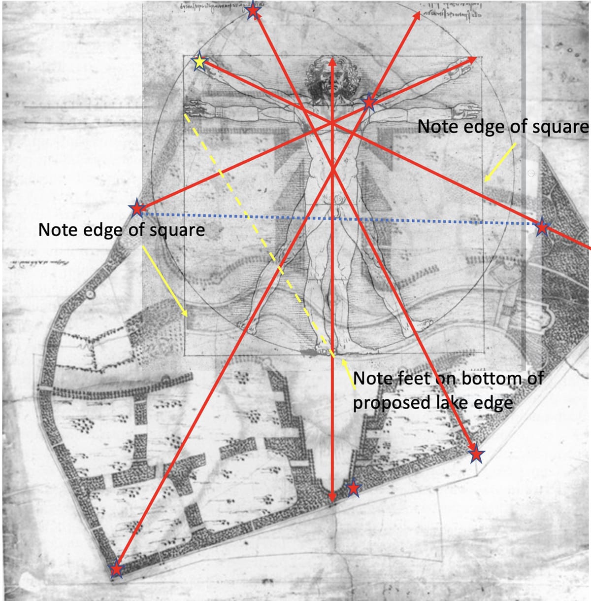
After discovering that the gates of nearby Sherborne Park were constructed in pairs that, when connected by lines, run parallel to Sherborne House's orientation, I began analysing Lodge Park's gates as well - and found something much more complex and remarkable. Here below the gates are marked with a red star:
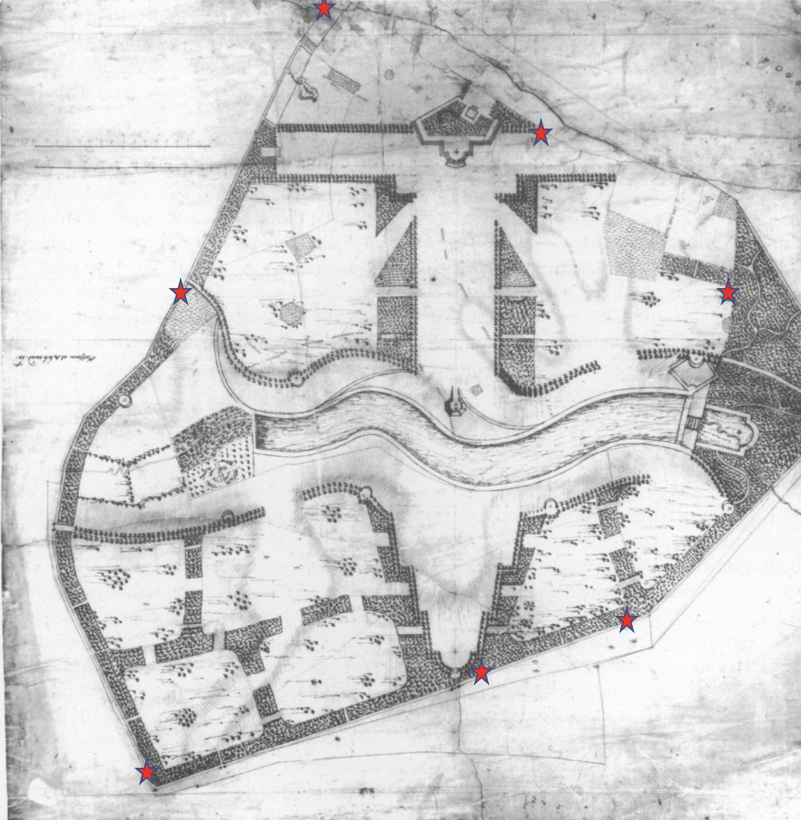
Looking at Bridgeman's original plan and the physical locations of gates (many of which appear quite old), I noticed something extraordinary: when I connect pairs of gates with lines and overlay Leonardo da Vinci's famous Vitruvian Man drawing, the extended lines along the limbs intersect precisely with the gates!

When the Vitruvian Man is scaled so that its height and finger-to-finger span are exactly 880 yards (matching the cross-bar of the "T" to the park boundary), all gate positions align perfectly with the figure's proportions. This seems far beyond coincidental
•Note how extended limbs lead to gates crossing navel or center of chest - key proportional parts of Vitruvian man.
•The Yellow star is a standing stone marked on Victorian maps
•Vitruvian man’s breadth is 880 yards, as is his height
•Waist exactly width of avenue
Note the dotted blue line, exactly perpendicular to Grand Avenue, both gates equidistant to centre(550 yards). Coincidence?
Further Geometric Precision
Even more remarkably, when connecting different pairs of gates, these lines intersect along the main central axis at very specific points corresponding to the Vitruvian figure's toe, genitals, and head - effectively marking the bottom, middle, and top of the figure.
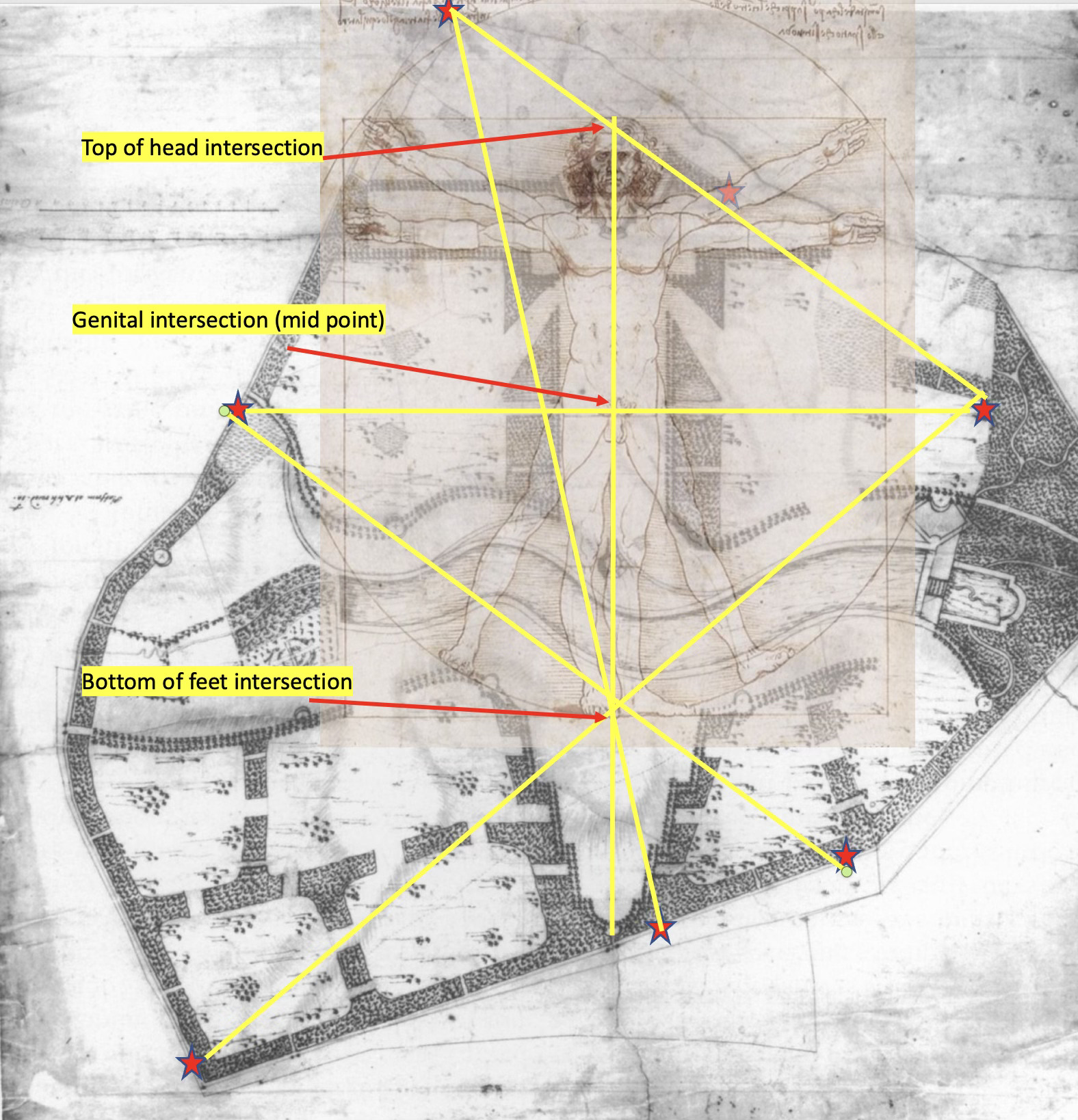
This represents very sophisticated geometric planning. By golly it’s clever.
The Vitruvian Triangle and Solstice Alignment
A Vitruvian Man diagram features a square, circle, and isosceles triangle. In Lodge Park's case, both the square and isosceles triangle have dimensions of exactly 880 yards on each face.
What's truly astonishing is that the left side of the isosceles triangle:
- Intersects the Long Barrow
- Runs between two ancient oak trees (at least 500 years old, predating the park)
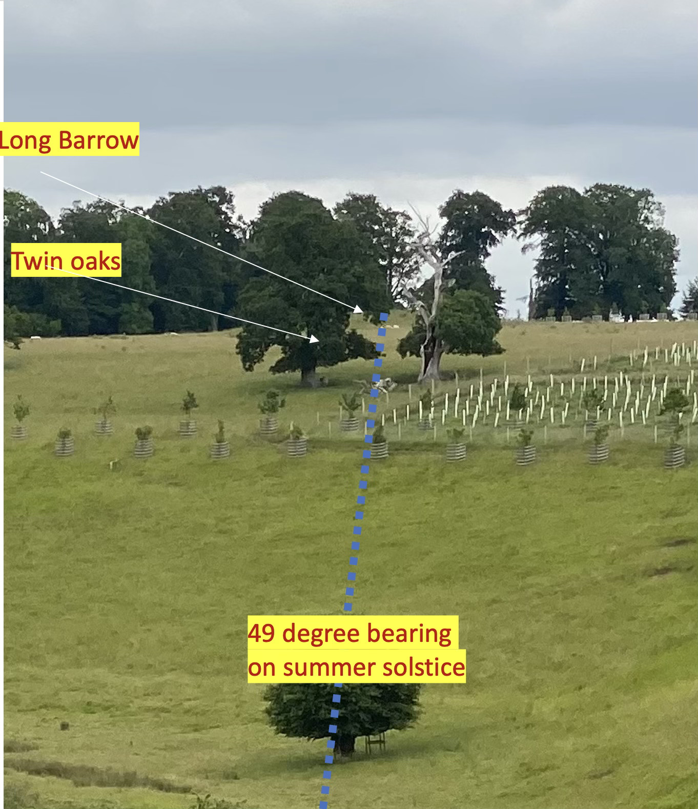
- Runs at precisely 49 degrees - the angle of sunrise on the summer solstice
This means if you stand at the position corresponding to the Vitruvian Man's toes, the summer solstice sun rises between these ancient oaks, directly over the Long Barrow on the horizon. The precision of this alignment is remarkable.
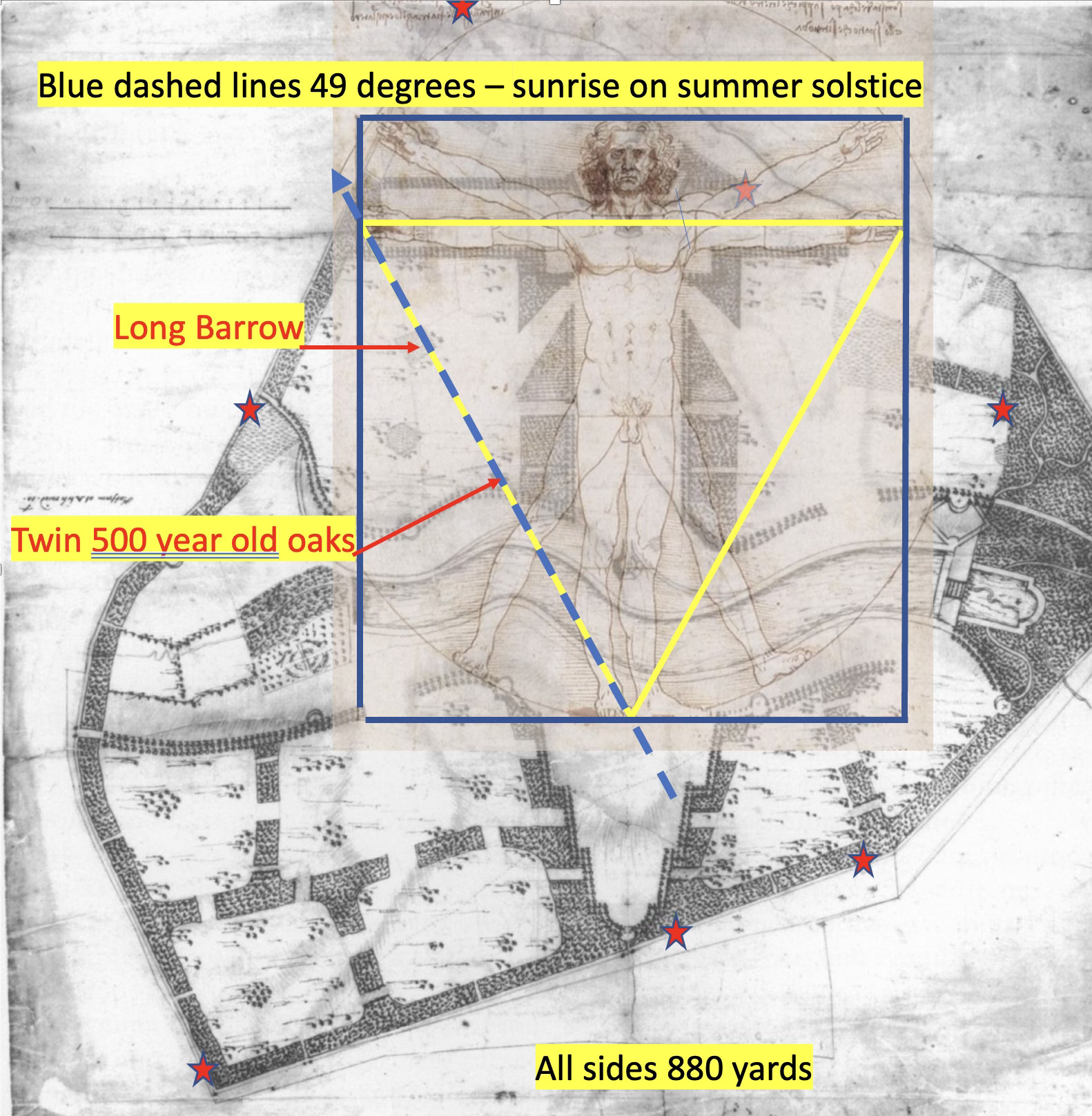
Note how the recent planting will obscure this alignment in coming years.
Unresolved Questions
These observations raise several fascinating puzzles that I'm still investigating:
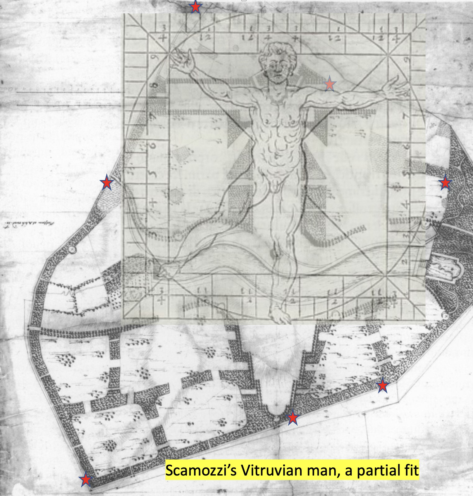
The Da Vinci Conundrum: Da Vinci's specific version of the Vitruvian Man was effectively unknown until the 19th century, yet the park's geometry matches it perfectly. How is this possible? I've compared other historical Vitruvian figures (like Scamozzi's version below), but their angles don't all perfectly align with the park features - look at the outstretched left leg. I’m deep into Palladio at the moment, looking for a solution.
Precise Measurements: The dimensions use multiples of 22 yards (a chain) throughout the design - For example the distance between gates across the centre is exactly 1100 yards, the top of the "T" is 880 yards, etc. More analysis to be done.
The placement of the Grandstand in the design. New evidence suggest it might have been scheduled to be moved to the head of the Grand avenue but was left in its rather “disconnected”position due to cost. Still to be confirmed.
Incorporating Ancient Features: The solstice alignment through oak trees planted around 1500 suggests the solstice line was physically established long before the park's creation, then deliberately incorporated into the later design. Who was laying out solstice lines in about 1500?! Furthermore the head of the Grand Avenue sits exactly on a key Anglo-Saxon boundary point , where three Anglo Saxon “hundreds” meet. What a coincidence! There are also a number of fallen orthostats , flush with the ground on apparently key geometric points. If you buy me a beer I’ll show you where.
The canal. Its date, its purpose and another lake that appears later in history downstream.
The Two Bridges. On the face of it these appear to be two functional, utilitarian bridges over the river. But there’s much more to them then meets the eye.
Hidden shapes: The parkland hides a raised octagon and a raised hexagon, of intriguing proportions and placements, predating Bridgeman.
Historical Secrecy: Why has this sophisticated geometric design remained unnoticed or undocumented for centuries?
More secrets to be explored. I also have a few other matters “up my sleeve”, including more peculiar mathematical observations if anyone is interested.
I continue to search the archives for answers about how the parkland evolved, particularly how it was expanded in the 1720s, and whether land purchases were made specifically to accommodate this geometric plan.
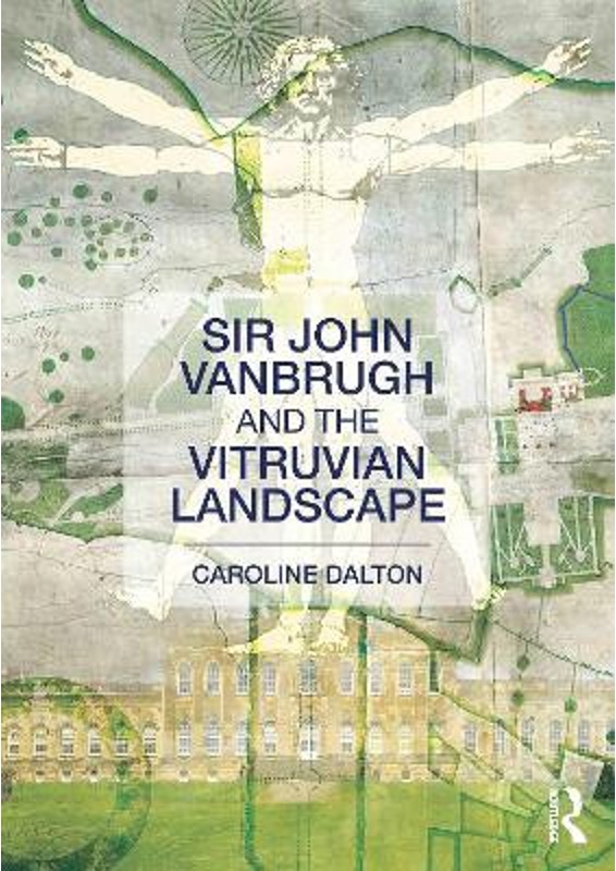
If you think I’m pushing the case too hard for a Vitruvian man used in parkland designs in the early 18th C or before then, take a look at this book, published by Routledge in 2012 - I’m trying to contact the author, so far with no success. Candidly, the case of a Vitruvian Landscape is stronger here than many of the landscapes Dalton considers.
What's Next?
I welcome your thoughts, questions, and insights about these discoveries. Frankly this is a huge puzzle and I can’t cover all aspects myself. Have you noticed similar geometric patterns in other historic landscapes? ( I have, in Greenwich Park, associated with Inigo Jones). Do you have GIS skills and interest in helping further analyse this fascinating place?
In the coming months, I'll be developing and sharing my formal paper with more detailed evidence, precise measurements, and historical context. Until then, if you visit Lodge Park, take a moment to consider the remarkable mathematical design potentially hidden in its layout - a sophisticated design that may have gone unrecognised for centuries. If you see an odd fellow pacing about with an old Army prismatic compass, a quizzical look and maps fluttering about, it’s probably me.
