Planning Application Affecting the Sherborne Brook
Grade 2 listed parkland and Conservation Area affected.
A few matters to bring to your attention:
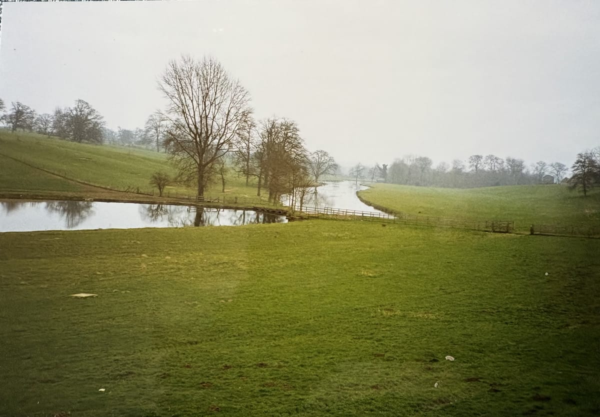
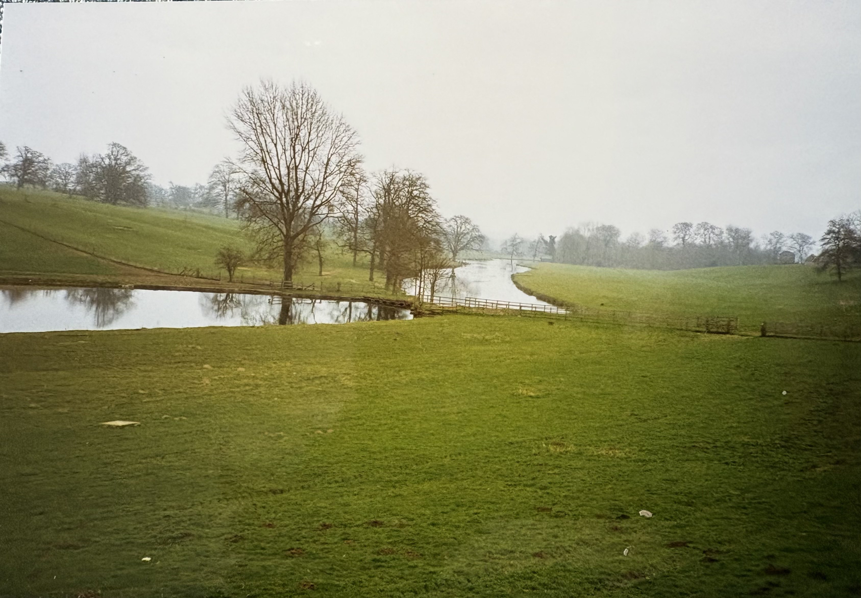
- I thought you might like to see this interesting photograph from 1993, showing the spine of open water in the valley bottom of the two lakes, the lower lake clearly serpentine in form.
The NT’s plans for the wetland creation at the upstream end of the Broadwater have been published in detail on the CDC website today. Here’s a link to the twenty (!) documents. I encourage all the Sherbrooke Brook group to go through these in some detail, as I am doing. I’m not going to tell you what to think of it. The application includes the NT’s comments on its community engagement, which I would encourage you to read and consider in some depth. This plan affects the very heart of our village and the brook in the valley bottom. It’s important and you have the opportunity to support, object or just make comment. You can do so via the CDC website. If you’d prefer to comment anonymously I’m sure the Parish Council could help you in that regard - approach a Parish Councillor, express your comments and say you’d like to stay anonymous.
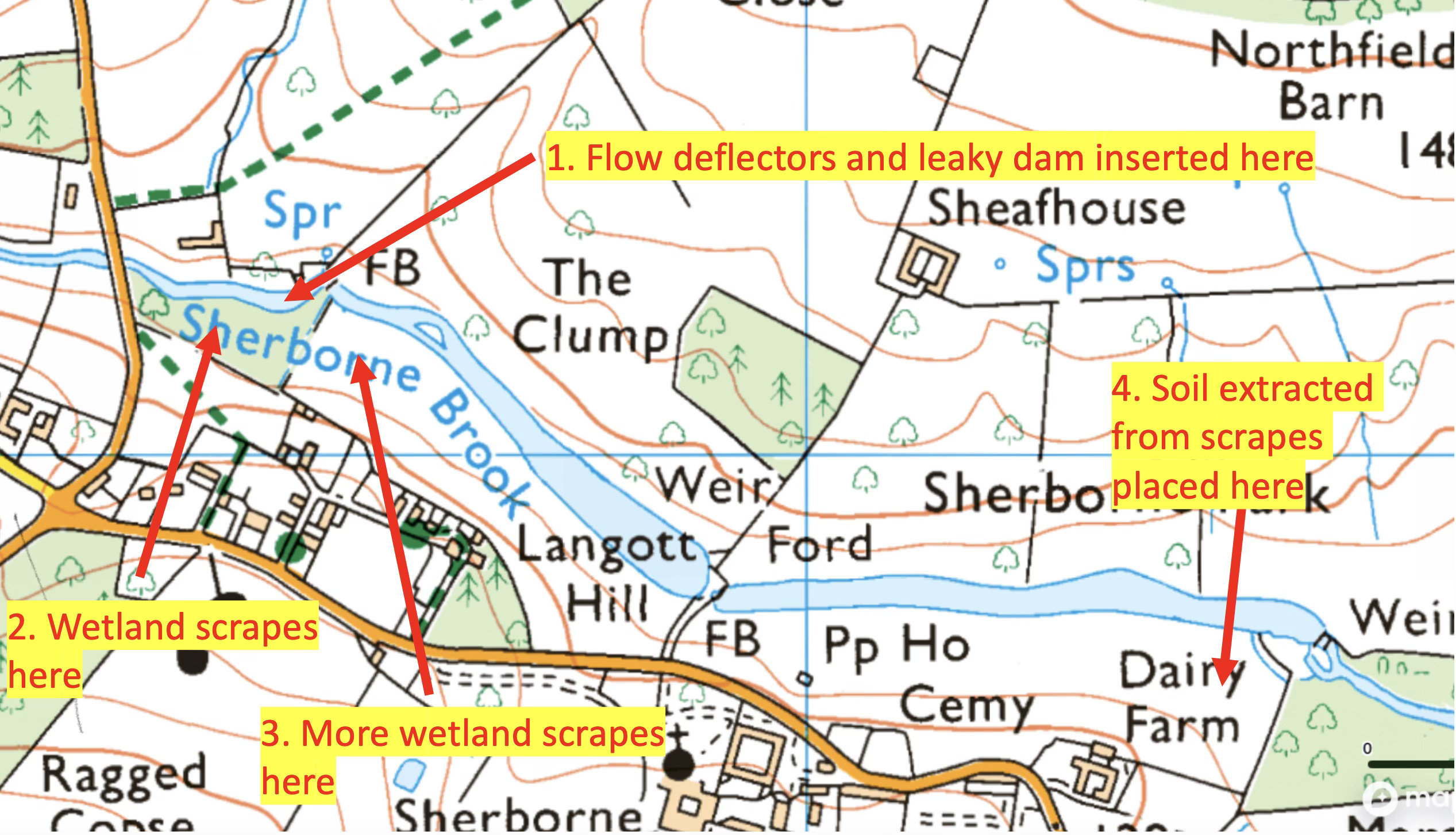
Some of the mapping used in the planning can be confusing so I thought the image below using a more familiar map may help give you context. I don’t think what I show below is incorrect. The scrapes at 2 and 3 will be bulldozed and the excess material taken down the side of the brook to area 4.
As an additional challenge to the lakes, this weekend I encountered invasive crayfish in the area of Waterloo Bridge (upstream of both lakes) for the first time ever. These creatures can burrow away at the banks of the watercourse and pose radical problems that are almost impossible to solve.
Thanks to those of you who responded to my discussion in my last post of the possible Roman Villa downstream on the Sherborne Brook towards the junction with the Windrush. Your various responses added to the understanding we have of this remarkable area. I had a useful and positive meeting today with Andrew Danson of the NT to discuss this matter. He confirms that the general area down there is being considered with a feasibility study to create further wetland areas here, noting the original course of the meandering river here. As part of that feasibility study they have engaged a “geo-phys” survey and the scientists have been informed of our “observations” and the knowledge we as a community have of that area down there. This will further focus their technical exploration. This engagement is as it should be, the NT listening and drawing on community knowledge early. I regard this recent meeting about the villa as a positive step.
