Possible Discovery of a Long-Forgotten Neolithic Long Barrow in Windrush
Is it or isn't it?
My hunt for ancient features in the local landscape is perhaps getting a little obsessive, but I find it very exciting. Today's possible find is a good example of the technique I've developed over time. Over the last few months, I have come to realise that burial mounds from both the Neolithic (Long Barrows) and Bronze Age (Round barrows) are more prevalent in the local area than one might expect. For those unfamiliar with these prehistoric sites, Historic England provides an excellent introduction to prehistoric barrows and burial mounds.
The Cotswold Landscape is ancient, and while the signs are sometimes hidden, metaphorically scratching away at the surface leads to new insights. There are many known tumuli in the local area - many shown on modern Ordnance Survey Maps, even more on Victorian OS maps, and many more still not marked at all.
Identifying Ancient Barrows: What to Look For
The number of "known and accepted" barrow sites allows us to consider the geographic characteristics of local sites. This is not an absolute list—not all barrows exhibit all these characteristics—but if a particular site has a number of them, then it's worth further investigation.
Ancient barrows in this region tend to be positioned in elevated locations on an escarpment, ridge line, or a false ridge line (a place that looks like a ridge from a valley below). They typically overlook valleys and are often oriented East-West. You'll frequently find them near parish or hundred boundaries and close to springs or sources of water. Many are also situated near quarries.
Physical evidence might include large stones, particularly at the eastern ends. When considering the broader landscape, these sites often exist within an apparent wider ritual landscape, aligned with other barrows in relation to winter or summer solstice sunrises and sunsets. Some round barrows appear to have been built in association with earlier long barrows, and many are within line of sight of other barrows.
Vegetation patterns provide additional clues. Barrows are often found within small copses at the edge of fields, suggesting that the immediate area was avoided by farmers in the past—either out of respect, superstition, or because large stones used in the construction obstructed the plough. If these rectangular copses are of the order of 20-50m long, they could contain a long barrow.
Place names offer valuable insights too. The word "berry" is a good clue, as are "tump" and, obviously, "barrow." Surprisingly, wildlife can also be indicative—badger occupation seems to be common, as badgers may find the raised mound with steep sides particularly conducive to their setts. Hollow spaces inside make good badger bedrooms. For useful context, about half of all the burial mounds in Salisbury Plain are occupied by badgers.
Finally, these ancient sites are typically located alongside natural routes through the landscape, meaning they are often found adjacent to roads, tracks, or footpaths today.
My Investigative Process
My approach to discovering these hidden monuments varies but typically includes several methods. I often meander the local area on my bike, peering through hedges and across fields, noting places that meet multiple criteria from my list. I also conduct research at home, examining modern and old ordnance survey maps using some very good online resources now available.
Other valuable sources include antique maps and estate plans from archives, tithe maps, Lidar imagery, and aerial imagery tools such as Apple Maps and Google Earth. I also consult Historic Environment Records, though these can be somewhat clunky to use and shouldn't be relied upon exclusively. The "Know your Place" website, which (if you ask it) shows HER overlaid on an old OS map, has proven particularly useful.
The Windrush Discovery
In this particular case, I was examining an early Victorian estate plan for the village of Windrush, Gloucestershire, obtained from the Gloucestershire Archives. The estate plan is a simple map showing houses and surrounding fields. What caught my attention was a field named "Noseberry."
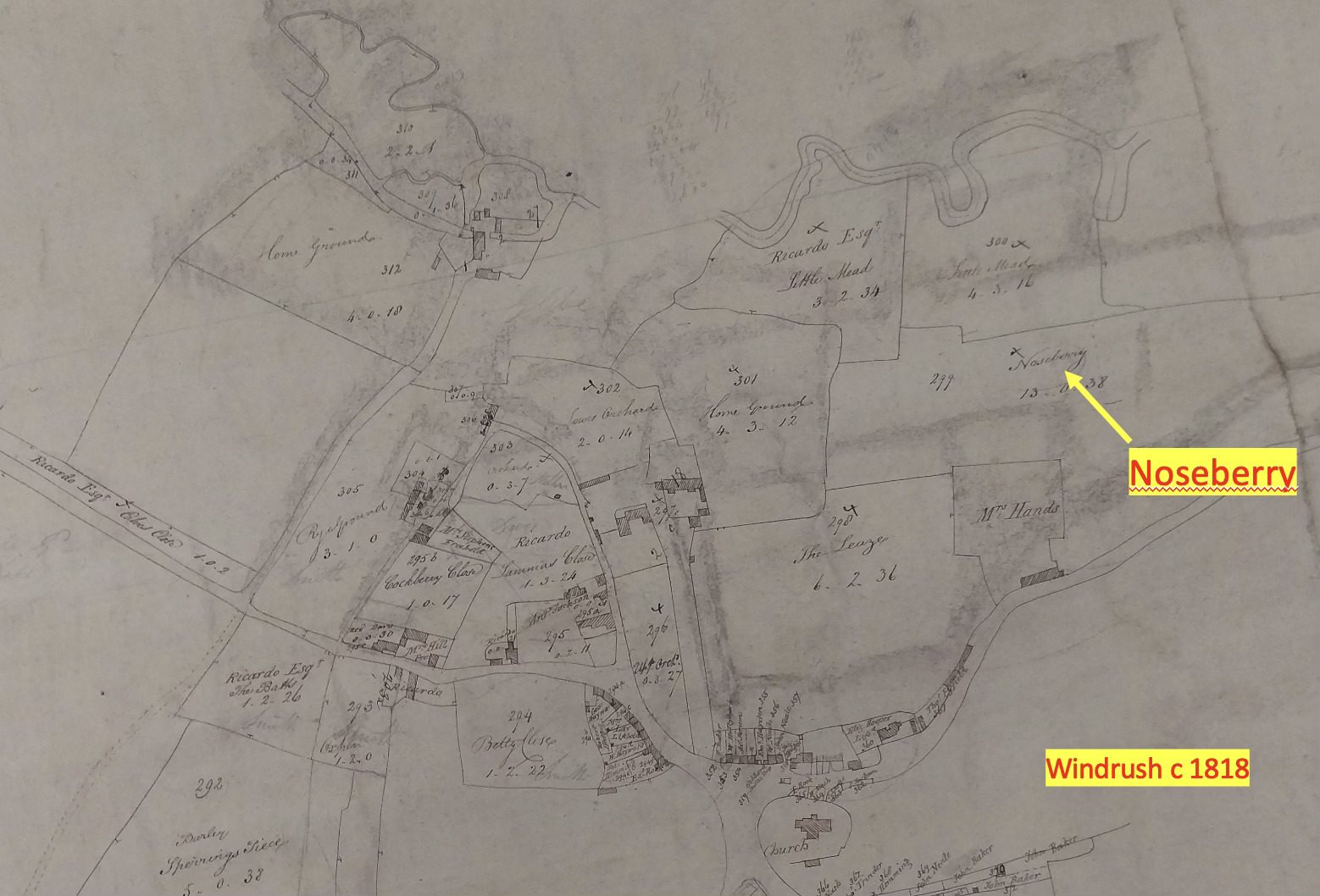
That made me sit up. The "berry" suffix has perhaps nothing to do with berries that one eats but could indicate a burial mound in the area. I was also intrigued by the prefix "nose"—as well as its literal meaning, "nose" can refer to a prominent landscape feature. The word has an interesting etymology, coming from the Old English "nosu" or "nasu,", which itself derives from the Proto-Germanic "*nasō." “Ness” seems to have as similar etymology.
When applied to landscape features, "nose" is used metaphorically to describe projecting parts of land: a promontory extending toward water, a projecting ridge of a hill, or the end of a ridge descending into lower ground. This usage emerged from the physical resemblance to the human nose—these features protrude from the main landmass just as the nose protrudes from the face.
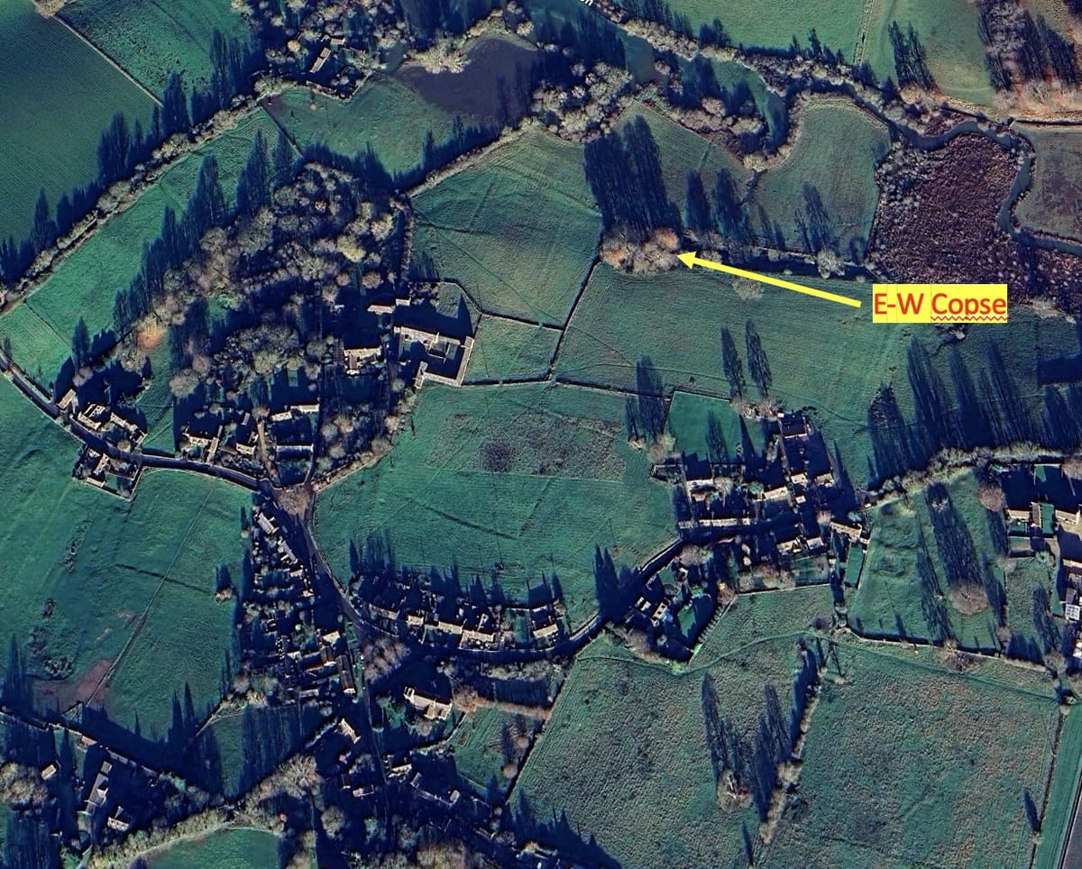
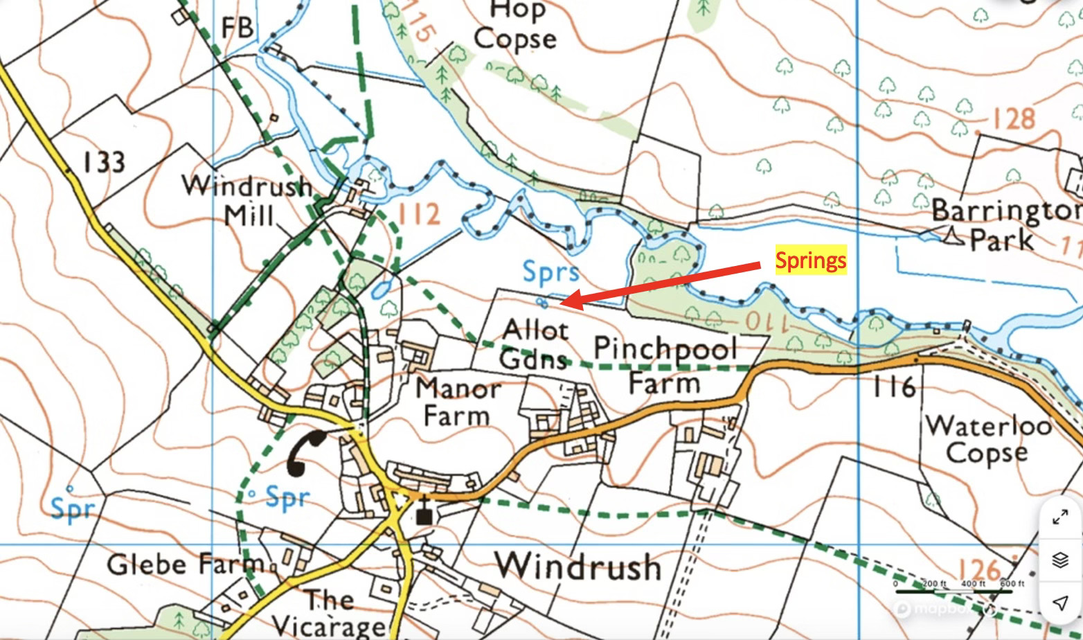
My next step was to consult a modern Ordnance Survey map. It immediately revealed a small escarpment on the northern boundary of Noseberry field, overlooking the Windrush river valley. The map also showed clear springs marked right on this northern edge. A pathway, possibly ancient, runs east-west a few tens of yards south.
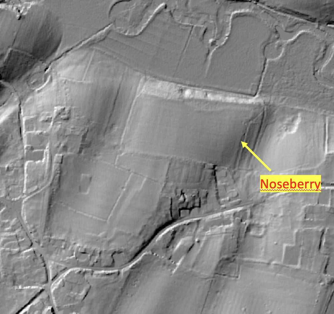
Aerial imagery further confirmed my suspicions, showing a small copse aligned east-west along this escarpment boundary. While LiDAR imaging doesn't clearly show a longitudinal barrow shape, this isn't surprising. A significant proportion of barrows have simply been eroded away over the years—by weather, by human extraction of stone for local structures, or by agricultural ploughing.

This site seems to be ticking a lot of boxes on my checklist of barrow characteristics.
Why These Ancient Sites Become Forgotten
Barrows can fade from memory and recognition for various reasons. Villages can be abandoned over the centuries and re-occupied. Once eroded, as many and perhaps even most have been, a lack of inquisitiveness causes forgetfulness. In some cases, the church frowned upon recognising what they regarded as pagan worship sites. Sometimes it's just the inevitable passage of time.
So today it was time now to put my boots on and go for a closer look, and I was genuinely excited!
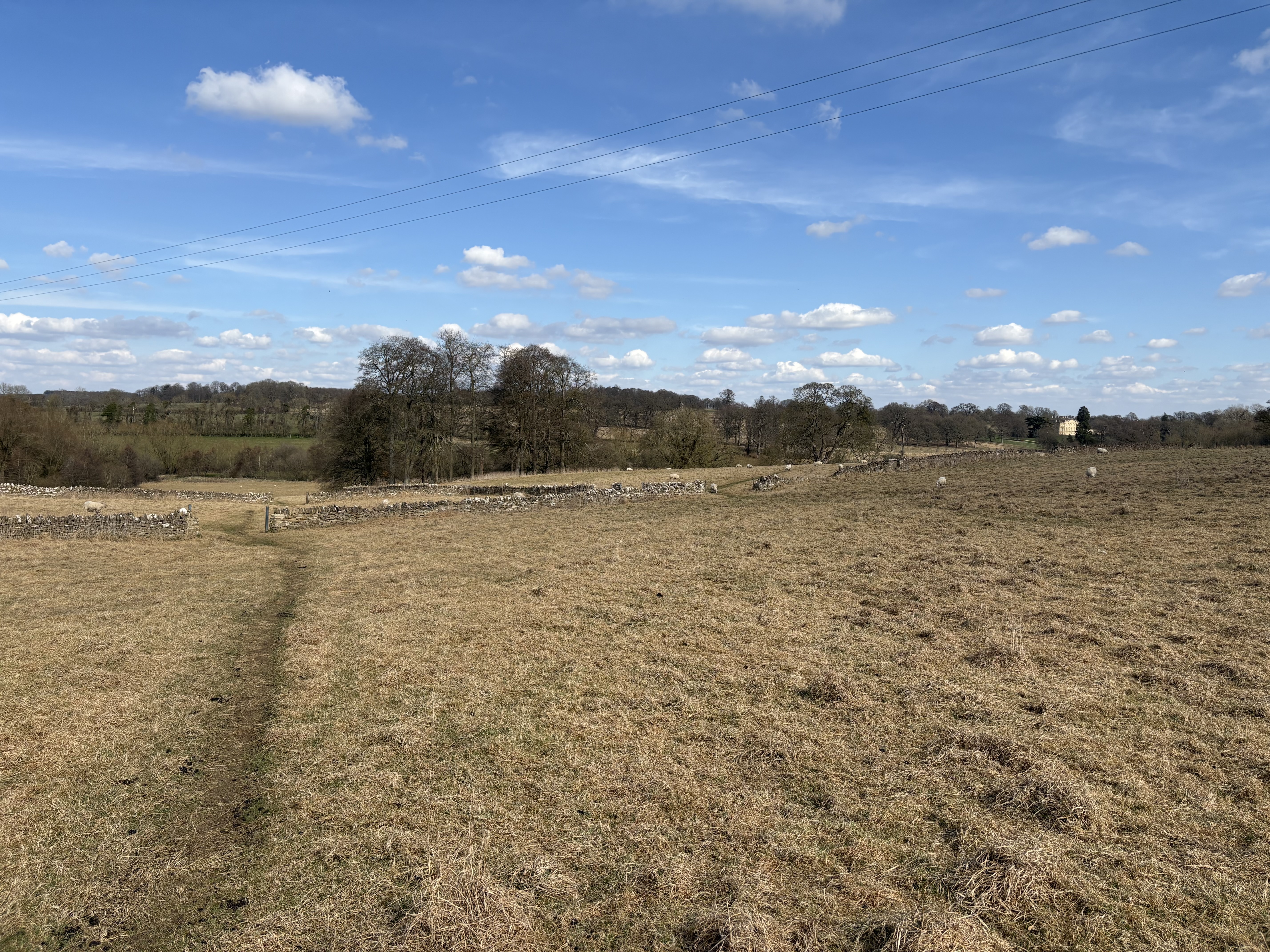
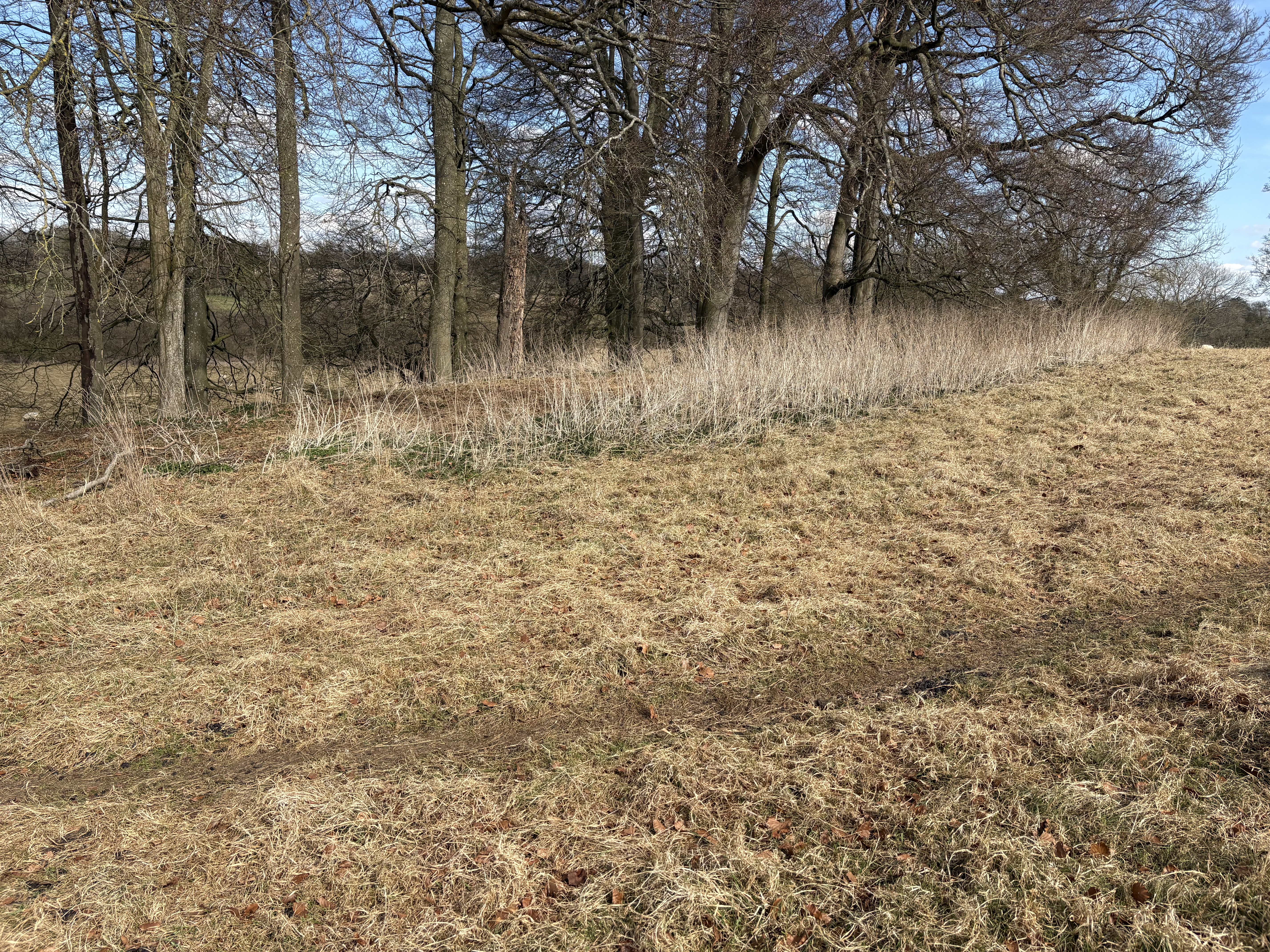
Above, the suspect area from the south, and below closer, with the possibility of a barrow running along the line of the tall vegetation. The trees are just beyond, planted down the side of the escarpment. The springs are at the base of this slope, straight ahead from the point here.
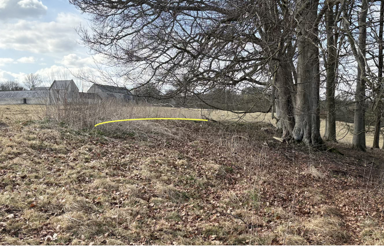
And here, below, looking west is a representation in the yellow line of what I imagine might be the length of the possible barrow. In a perfect barrow there would be a ditch and a rise in the ground on the southern side, but given this lies on the edge of a field that no doubt was once ploughed I’d expect the ditch to fill in over time, and also on the downward northern slope that would erode down the hill in time.
So - bottom line, I think this is only a “possible” barrow site. It matches quite a surprising number of criteria but needs further investigation to confirm or deny my amateur assessment. The land here belongs to the National Trust and they have shown no interest in exploring the two other possible Long Barrows I have pointed out on their land in the local estate so I suspect we will have to leave it there.
But as a community, it’s worth being aware of the possibility. One can't help imagining that this possible barrow is occupied by some of the first Windrush settlers from 5,500 years ago. Have they left their mark, and if we look carefully, we can still see evidence of their lives? I think that's thrilling, and true heritage.
