Possible Long Barrow spotted on a Hundred Zig Zag
Sherborne's boundary suggests an ancient marker.
As you know, I am carefully researching the peculiar zig zags on the Northern Parish boundary, on the off chance the boundary was originally defined by an Anglo-Saxon charter, “perambulating” along much older features, and I have some preliminary suspicions that the zig zags could have been older prehistoric features. I’m still examining old maps and alignments, and building up a careful contextual case. In the meantime, in what might be criticised as a scatter-gun approach, another zig zag, elsewhere on the Hundred boundary grabbed my attention. Let me explain what I may have spotted.
A reminder, the Hundred Boundary was defined by the Anglo-Saxons as an administrative area, and before parishes were defined. I have reasons to make an assumption that the Hundred boundary that also forms the western and southern parish boundary of Sherborne, may have been defined when King Cynewulf gave Sherborne to Winchcombe Abbey in about 811 AD. The Anglo-Saxons didn’t have maps as such so defined the boundary as a list of landscape features that could be followed as one walked or “perambulated” round the countryside.
So, if our western boundary was defined in c811 AD, the features on that boundary could well be older and utilised by the Anglo-Saxons to define a border. The line of the boundary has been passed down over the centuries, and I’m making the conjecture that there was often a reason, a point on the ground, where the boundary changed direction. Such places might be where streams met, where roads or tracks met, or indeed where ancient burial mounds were apparent to the Anglo Saxons. Remember these burial mounds might be circular, and date from the Bronze Age (c 2000- 2500 BC) or more linear, (and date from c 3000 to 3500 BC). the Anglo Saxons were around much more recently from about 550 AD
I think many of these features have been lost over the centuries, forgotten, eroded or ploughed under, especially by modern ploughs. Some remain, such as the Long Barrow in Lodge Park. There are a surprising number in the local area. I have been gathering the characteristics of local long barrows, and some of these characteristics include:
- Views over a valley below
- At least 25m long
- Aligned roughly E-W.
- Often “invaded” by badgers who find the barrows perfect for their use.
- On or near ancient boundaries
- Within sight of other barrows.
- Near to tracks, water sources and quarries
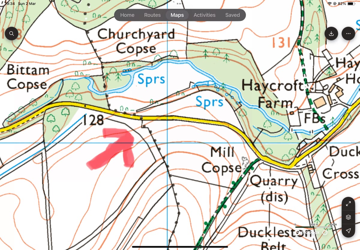
Anyways, I was looking at the map of the boundary between Sherborne and Farmington. Look here where the boundary , a series of black dots crosses the road and heads south. The crude arrow points to an intriguing zig zag in the boundary, about 30m south of the road.
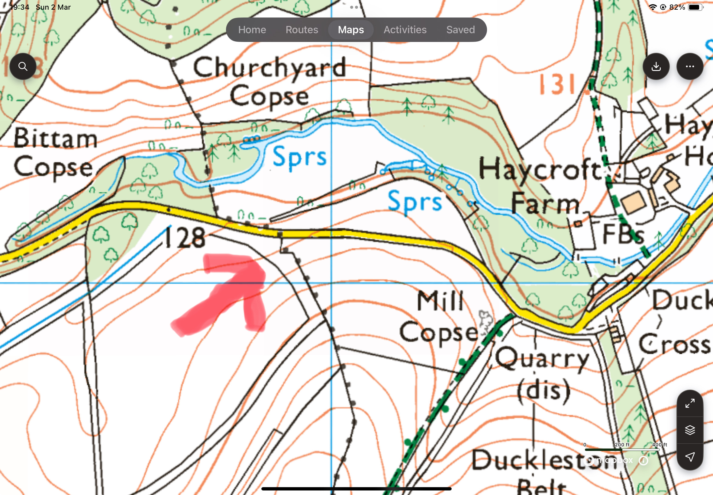
So my theory is that something caused the Anglo Saxon charter maker to cause the boundary to zig zag. What feature did the Anglo Saxon clerk reference to cause the change in direction? Is there anything at that spot still today? If so what might it be? The “zag”, is about 30m long and aligns E-W. This point overlooks the valley below and is near to water, and the road. Hmm. Now, most of the year, the foliage on the hedgrow and trees, blocks any view from the public highway, but as I pushed my bike along the road last week, the lack of leaves allowed a glimpse. I have also checked the LIDAR, and both suggest, perhaps, a raised feature about 30m long. Here’s a pic from the road, with some crude annotations.
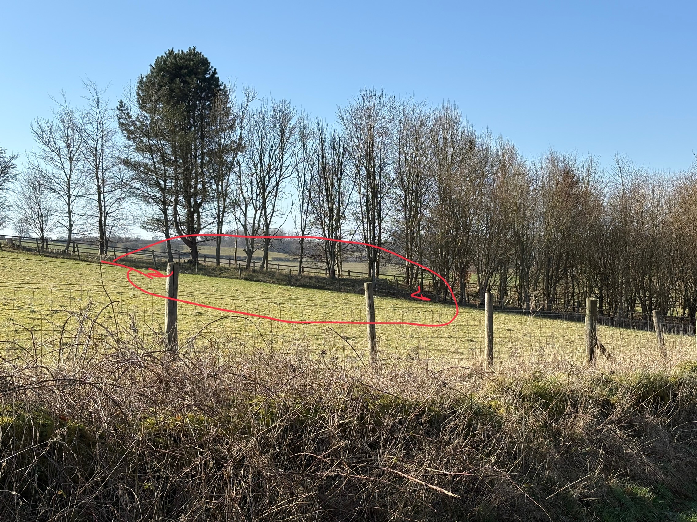
I appreciate that it’s only the faintest bump, but it’s certainly a bigger “bump” than some known long barrows in the local area. It’s the right size, the right orientation and the right place. My next step is to chat to the land owner of Empshill Farm, and seek permission to take some photos, then consult the Glos County archaeologist who have already accepted a long barrow I spotted further south from this point as a “possible”. Please don’t trespass as that might set the landowner against us. If anything comes of this I’ll request the landowner to see if we can do a walk and talk. I have checked the Historic Environment Records and there is nothing for this spot.
Let me know what you think. (Even if you think I’m an obsessive lunatic!). Perhaps drive along the road and peer up, before spring fills the hedges and the view is obscured. Dream, perhaps, like I do, about the people of Sherborne ( or Farmington! ) building this shrine or mausoleum 5500 years ago. I find it thrilling, but that thrill could cause me to be seeing things, so I need a sanity check. Does it look like a longitudinal mound to you? Does my logic make sense?
