Return to Sherborne's Puzzling Roman Villa
The curious inverted cropmark resolved.
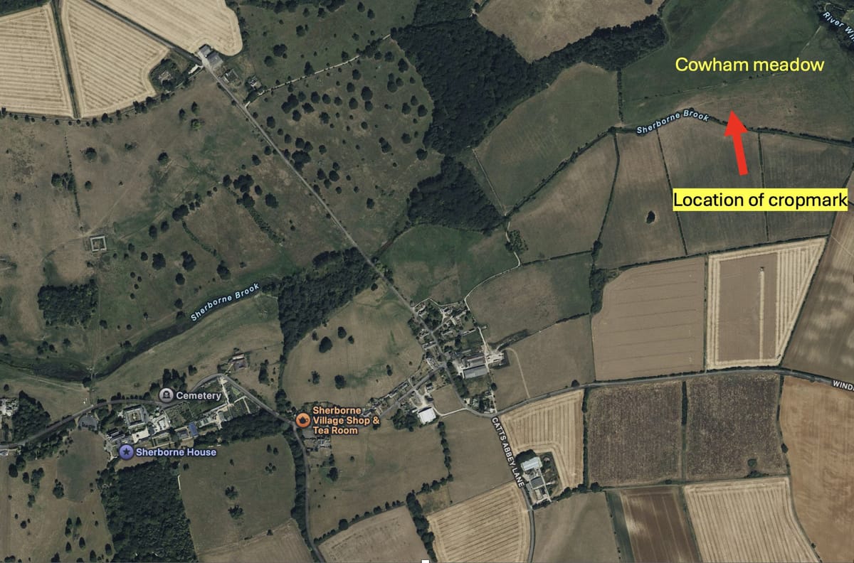
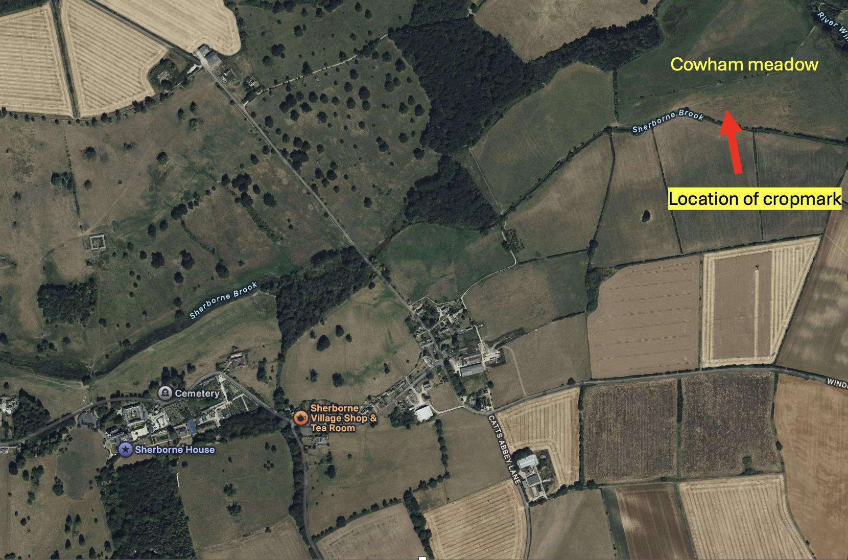
A few months ago I discussed the peculiar crop mark visible in some aerial photos in Cowham meadow in Sherborne. To remind you, this sits east of the parish, beside the meandering ghosts of Sherborne Brook's ancient course.
Here’s a zoom in:
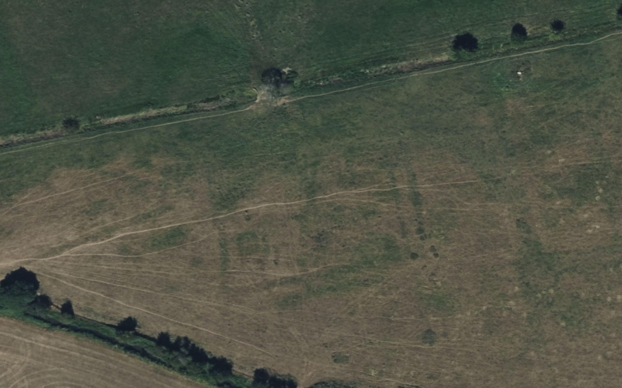
The rectangle visible is about 80m long and 40m across. That’s pretty big. This bit alone is broadly comparable in size to Chedworth villa and there is suspicion of more debris a little to the east where there is a more confused area. What struck me as odd was how these crop marks defied normal expectations. Stone walls usually create lighter patches where shallow roots struggle above buried masonry. But Cowham's darker lines suggested something different - richer soil following linear patterns that whispered of human construction.
The Gloucestershire County archaeologist helped me to solve this puzzle. Those dark features likely indicate "robbed-out" walls where stone has been systematically plundered. When walls are removed, they leave empty trenches, here in the clay substrate. Over centuries of grazing and ploughing, these trenches gradually fill with more fertile topsoil, creating the dark linear crop marks we see today.
But I kept wondering - what nearby structure could justify such extensive stone robbery?
Understanding Romano-British Villa Life
Romano-British villa complexes were far more than single buildings. A typical establishment comprised the main residential villa, often with heated rooms and decorative mosaics, alongside working buildings that made these estates largely self-sufficient agricultural enterprises.
Picture barns storing grain harvests, workshops where blacksmiths forged tools and carpenters crafted furniture. Granaries kept precious grain dry whilst stables housed working horses and oxen. Many complexes included their own bathhouses, complete with hypocaust heating systems. Kitchen gardens provided vegetables, whilst orchards offered fruit and nuts.
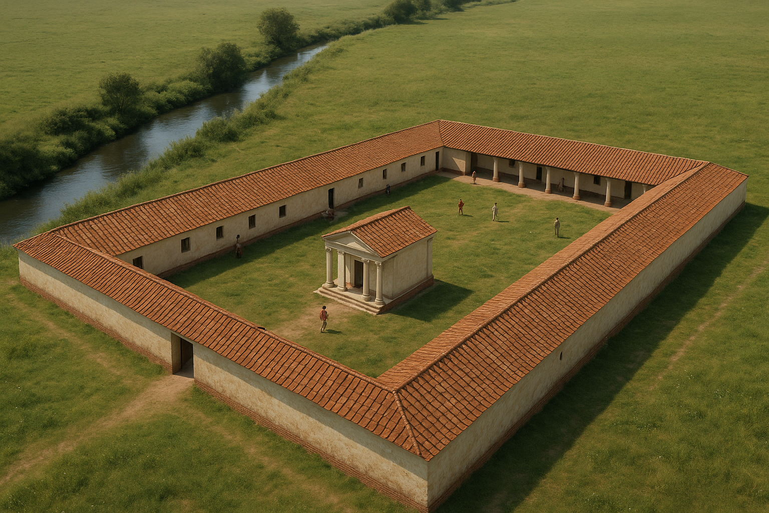
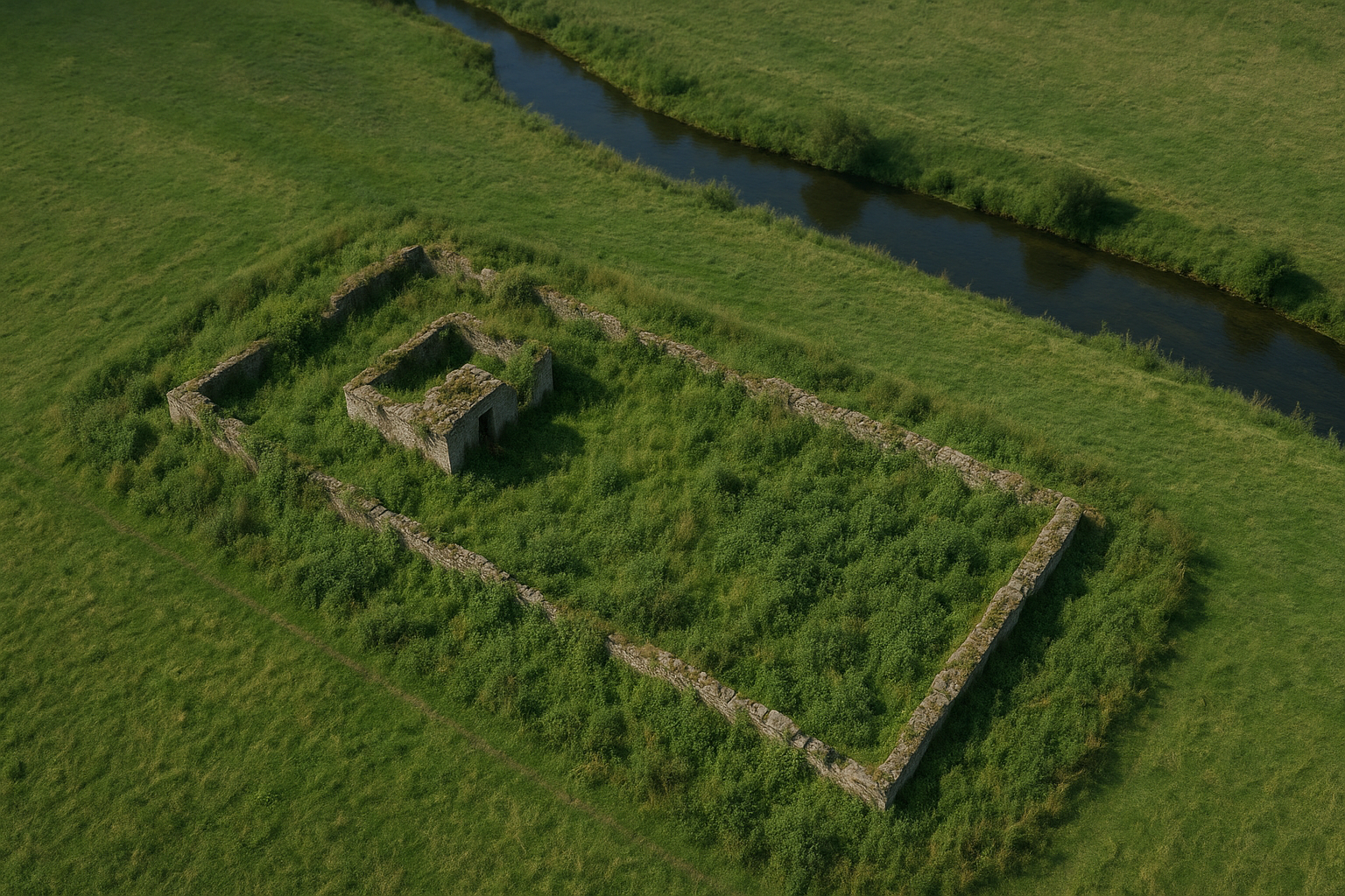
The rectangular crop marks at Cowham align perfectly with such arrangements, pretty typical of a Romano-British Villa, occupied by Sherborne’s predecessors nearly 2000 years ago. The main villa stretches some 80 metres, its twin walls suggesting substantial construction. The central square feature, in the left segment could represent a formal courtyard, perhaps with a small temple for household gods, or an ornamental pond reflecting Cotswold skies.
Here’s an AI image giving you a feel of what it may have looked like (my guesses only!):
Imagining Ancient Sherborne
Picture this villa complex in its heyday. The main residence sits above Sherborne Brook's southern bank (then a meandering brook just to the North , its red-tiled roof visible across the valley. Smoke rises from workshops where craftsmen busy themselves with daily tasks. Brook water flows clear and constant past the villa's threshold, feeding ornamental ponds and providing power for grain mills.
Here’s a Lidar Image of Cowham meadow and you can see the snake-like original course of the Brook.
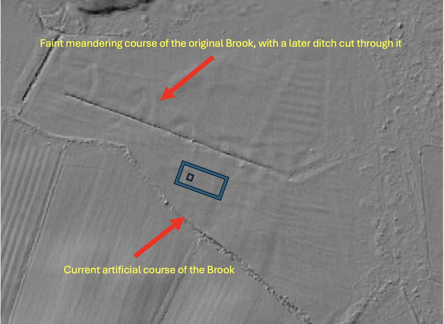
Roman farmers chose such spots deliberately - reliable water, fertile valley soil, and natural flood protection on raised ground. Here lived a Romano-British family for perhaps three centuries, watching seasons turn beside their productive stream.
Such riverside establishments dotted the Cotswolds. We know others existed at Chessels field towards Great Rissington, near Arnold's Spring above Sherborne Common, and Romano-British finds have also been discovered north of Woeful Lake. This landscape once buzzed with Roman agricultural enterprise. There has also been very interesting very recent Roman finds in the village of Sherborne itself which I’m not yet at liberty to share.
Stone Thieves and Water Engineers
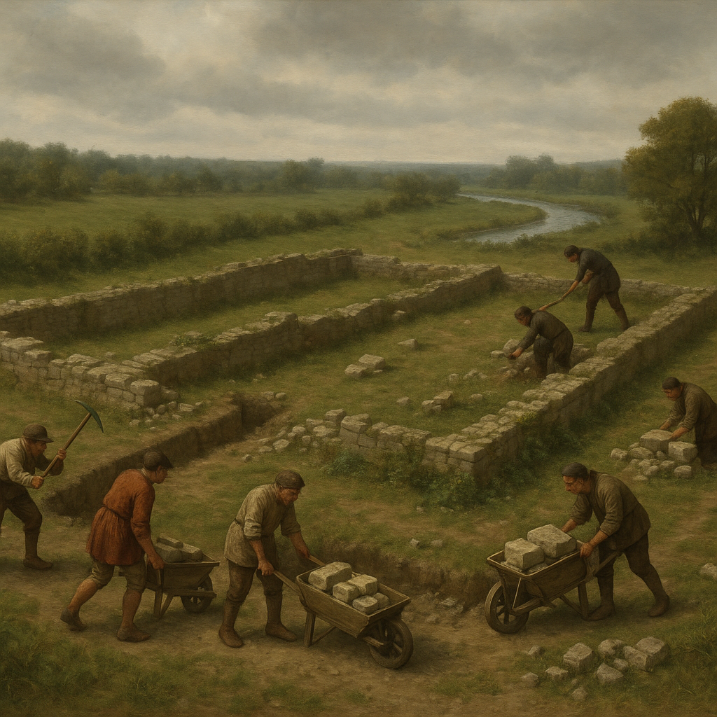
When empire collapsed in the 5th century, our villa fell silent. Roof tiles slipped, walls tumbled, and centuries of weather weakened careful Roman masonry. The working buildings - less robustly constructed than the main villa - likely disappeared first, their timber frames rotting and stone foundations scavenged piecemeal. maybe this is the ares to the East of the rectangle, where Roman material has been speculatively identified before. Here’s the Historic Environment Record, regrettably not that clear and continuing confused references to a site nearer Broadmoor Farm. By, say 1500 our villa site may have looked something like this:
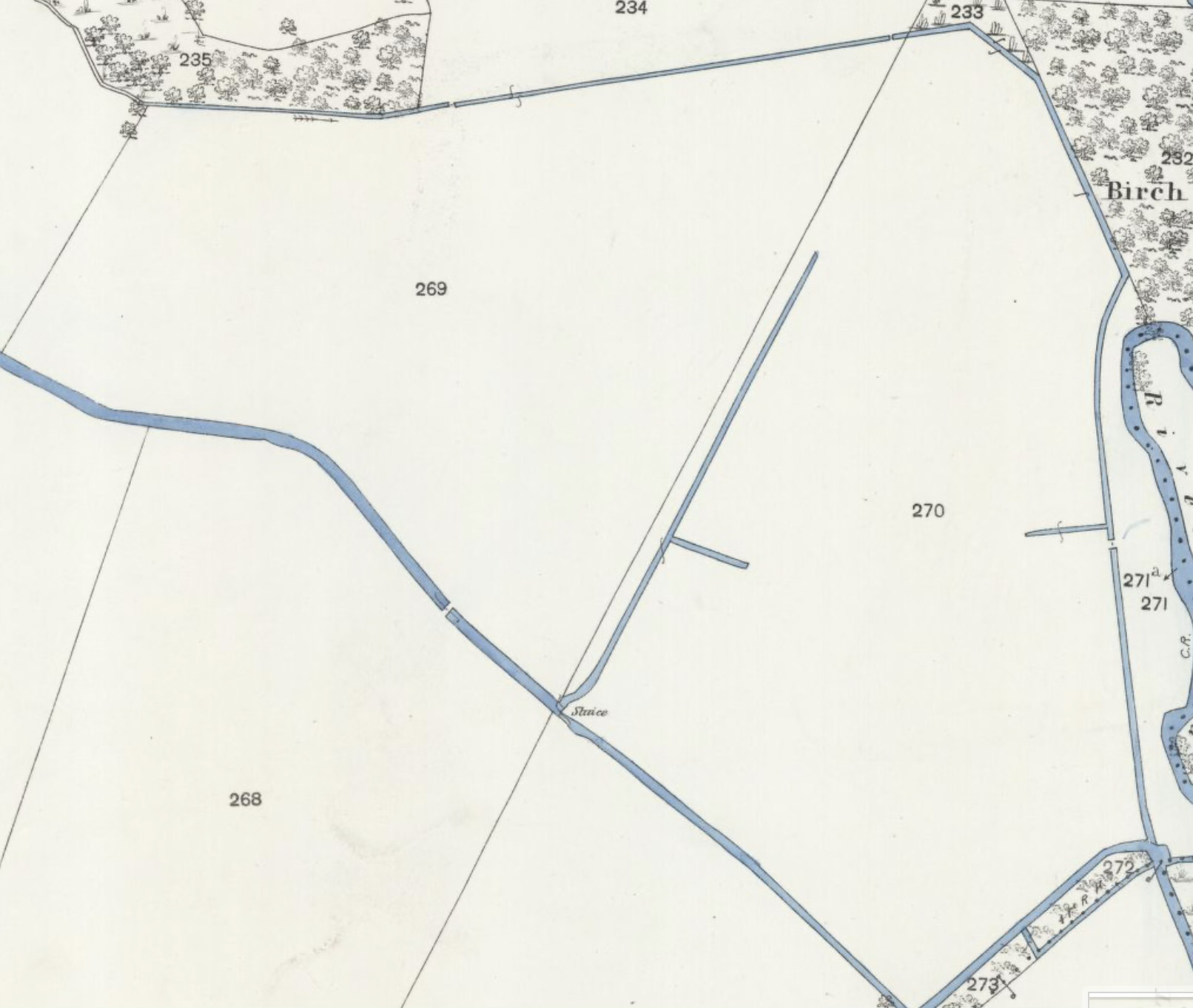
Fast-forward, now to ambitious water engineering - probably 17th or 18th century, though seemingly absent from detailed estate accounts. Someone decided to tame Sherborne Brook, creating the raised canalised channel we see today. This was for the purpose of created watermeadows or “drowned meadows” where pastures were flooded in the spring. This agricultural technique came to the fore in the late 15th/early 16th C and continued into the 19th C. The Windrush water meadows about a mile North were created at this later date but what we have here was certainly well before then, and existed prior to 1820. I’m going to speculatively suggest it could be 17th C.
Now, this is the key bit. Such work demanded substantial stone. A practical builder, surveying that convenient pile of dressed Roman masonry mere yards away, wouldn't hesitate. Why quarry fresh stone when centuries of Roman craftsmanship lay ready for reuse?
Here’s a late 19thC Ordnance Survey map, showing a substantial sluice just to the SE of the suspected villa. That area that this sluice flooded was called “Drowned meadow” in 1820.
Those regular blocks, carefully carved with consistent dimensions, made perfect material for raised brook walls and sluice construction. the current line of the Brook sits above the course of the original meanders, significantly. I am suggesting that the ancient villa became an opportune quarry. Workers systematically dug out foundation stones, leaving empty trenches in the underlying clay.
Over subsequent centuries, ploughing and natural soil movement gradually filled these hollows with fertile topsoil, creating the inverted crop marks that puzzled us today. The Brook then runs its current course, with the sluice being used to periodically flood the meadow (“Drowned Meadow”) to the East.
Mysteries and Archaeological Hints
This interpretation suggests remarkable archaeology still sleeps beneath Cowham's surface. Local gossip hints at discoveries that would fit perfectly with a villa of this scale. Some decades ago, according to anonymous village accounts, part of a mosaic was reportedly found in this vicinity. I cannot confirm this information (because it would be improper for me to dig with a spade), but if true, it represents exactly what one would expect in a Romano-British villa of this size and status.
Additionally, I have details of a find of coins - possibly five or six - discovered (I think) in this area during the 19th century. Again, such scattered coin hoards align precisely with villa sites, where occupants often buried valuables during uncertain times.
These fragments of social history, however unverifiable, paint a picture consistent with a substantial Romano-British establishment. Mosaics marked wealth and sophistication, whilst coin hoards suggest the kind of prosperity that villa agriculture could generate.
The existing sluice deserves careful examination. Reused Roman stone might bear telltale tool marks supporting our robbery theory.
If correct, this represents sophisticated early water management, predating the famous systems elsewhere in the parish by generations. I think that’s important to understand, and it’s particularly interesting if it used Romano-British masonry.
Questions Remain
While logical, this conjecture requires proof. The proportions fit, the location makes perfect sense, and the stone-theft explanation resolves that puzzling crop mark inversion.
I find this theory compelling because it connects multiple strands of evidence - archaeological, topographical, and social. It explains the anomalous crop marks whilst suggesting why this particular stretch of countryside has yielded scattered Roman finds over the years. Of course, as usual I invite refutation and alternate conjectures.
Sometimes imagination helps us see past landscapes clearly. I picture that Roman family, perhaps on summer evenings, watching brook water catch sunset light whilst listening to sounds from their busy workshops - never knowing their carefully built walls would one day serve new masters taming the very waters they had loved.
In a recent newsletter the land owners, the NT, suggest that this field is undergoing a feasibility study for wetland creation, and has been successful in obtaining £100k in DEFRA funding for this study. I don’t know what the feasibility study will come up with but I can imagine a return of those gentle meanders, and perhaps, I hope a little hole digging to uncover a mosaic- or two. I’ll pass the above along to the NT for consideration.
(Please note - this area discussed in this post is not accessible by any public footpath.)
