Sherborne in 1815
How close is our village history!
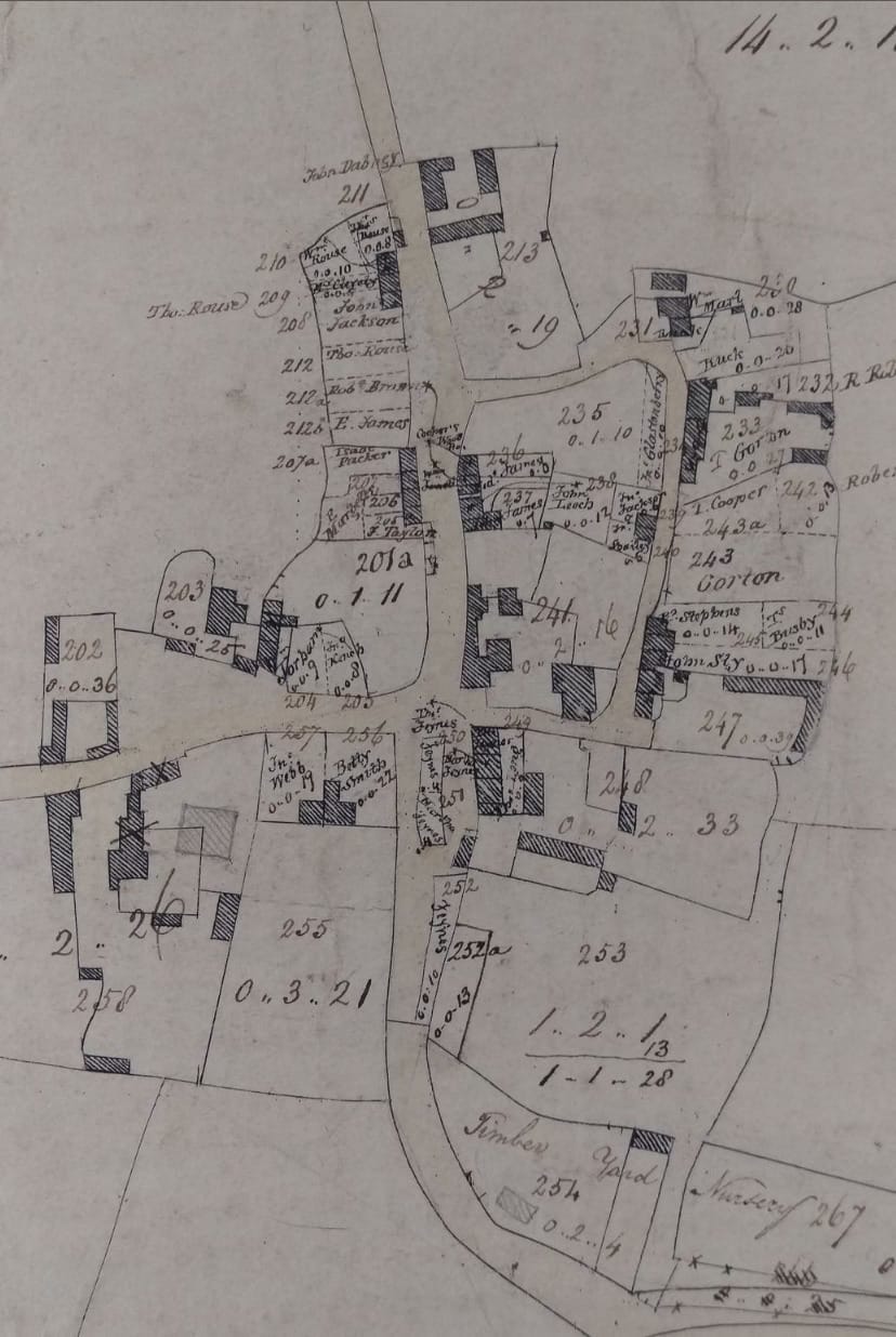
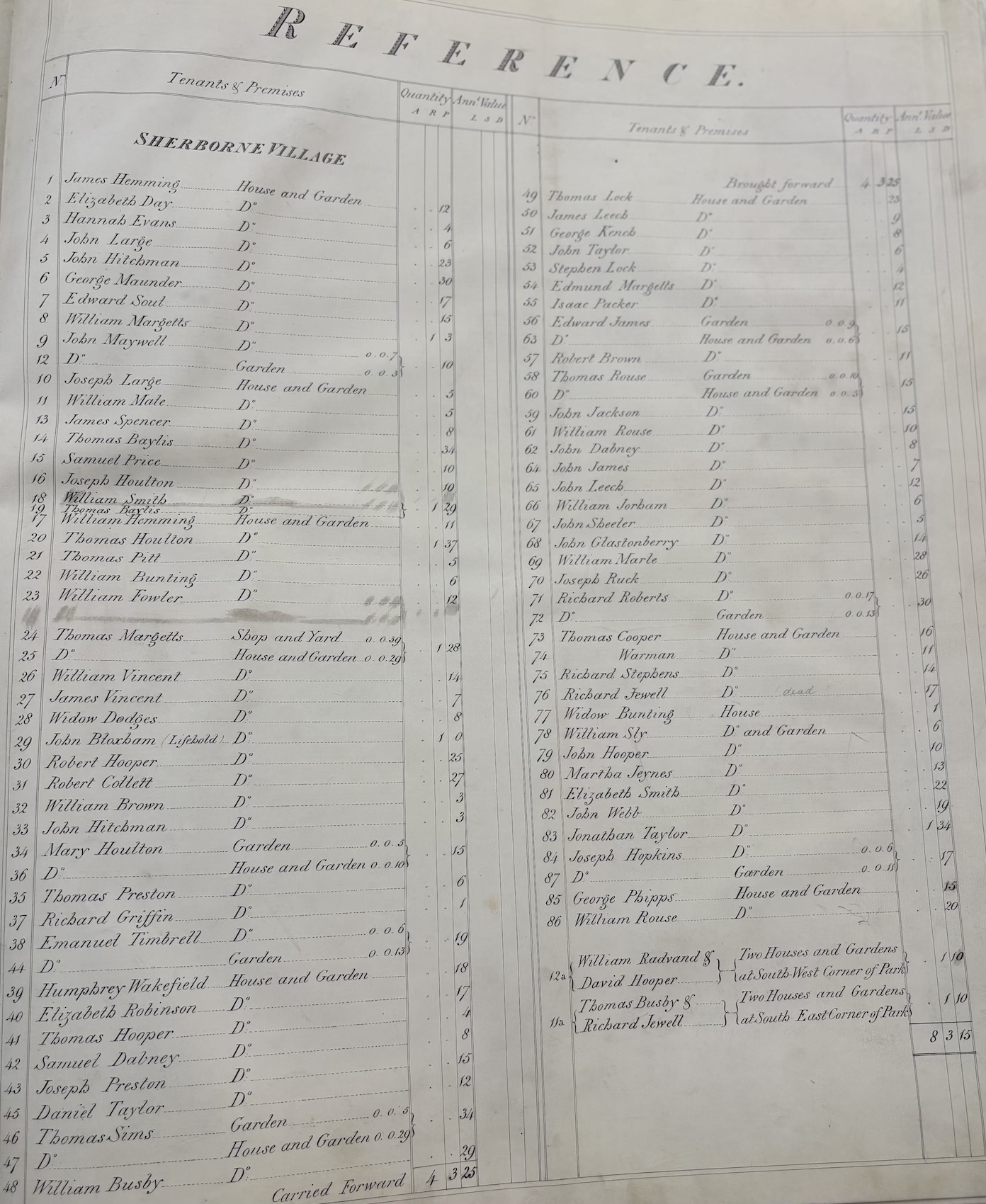
Many of you seemed to enjoy a recent post last week about the of names of the villagers who lived “west of the church” in Sherborne in the 13th Century. Here’s something similar about the people who lived in the “East” end of Sherborne in about 1815, give or take a year or two. The image below is centred around the bend in the road where Stones Farm and Sherborne Farm sit today.
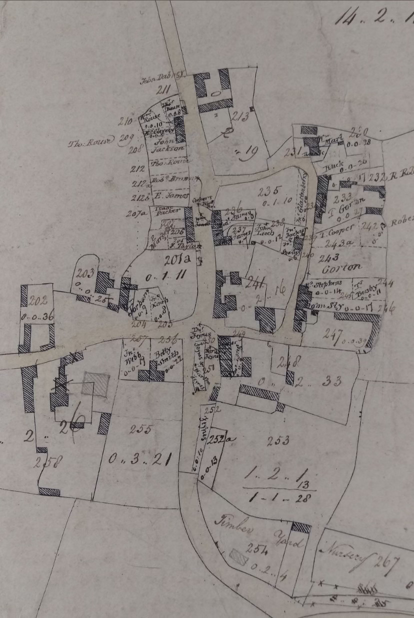
Stones Farm was built in 1818. You can see that after this sketch was drawn, someone later has pencilled in Stones Farm (I’ve marked it with an “A” in the comparative image below, but Stones Farm wasn’t on the original , so that’s why I think it dates from just before 1818. I think this was a preparatory drawing for the more well-known estate plan of 1820, which lists the tenants on a separate page.
Here’s a a side by side with the current east end of the village:
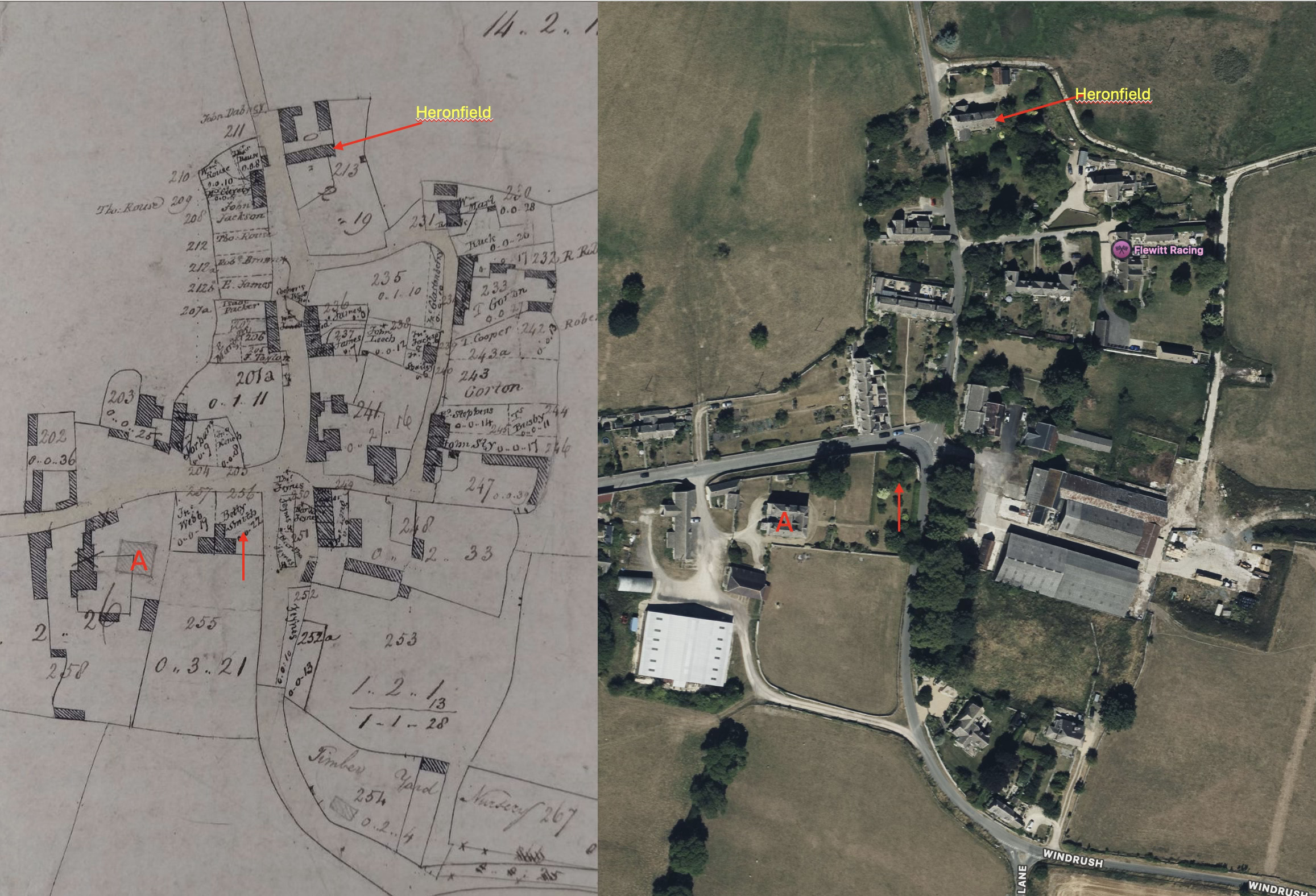
This plan has the various tenants annotated directly, where they lived or rented small patches of land. You will note for example there is a small house right on the corner where “Betty Smith” lives (arrowed in red) . In the 1820 version she is listed more formally as “Mrs Elizabeth Smith”. Her neighbour John Webb was still her neighbour in 1820. It’s worth trying to compare left and right. See what has changed and what has remained the same.
Several things jump out at me.
- Some of the houses were tiny. I’m not sure if they would be built from stone, brick or wood.
- Some houses remain the same, some have gone, many more added.
- Tiny strips of land are rented out, presumably as allotments. Look at the patch in the middle of the road right on the corner next to Betty’s place.
- The areas are recorded as a set of triple figures - acres, rods, and perches. A rod (or rood) is a quarter of an acre. A perch is a fortieth of a rood. It seems very accurate and carefully measured and recorded. Betty Smith’s plot for example is 25 perches on this 1815 plan but recorded as 22 perches in the 1820. A small difference. But someone had gone to the trouble to measure, survey and record the areasHere’s the village tenants from 1820. There are one or two surnames which will be familiar to us today.
Most of the names carried through from the first plan of 1815 to the tenants list of 1820, but not all.
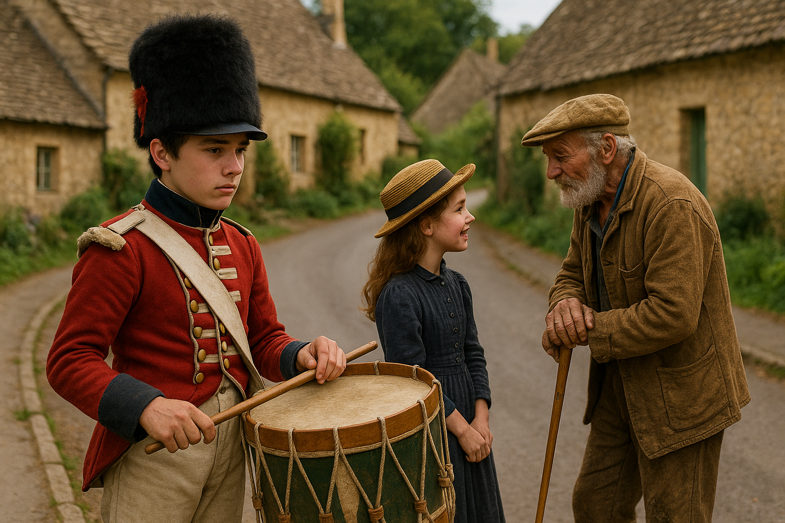
Remember too, how close history can be to us. This is 1815, the year of the great victory at the Battle of Waterloo. The late Will Tremaine who lived in his latter years at Heronfield, the northernmost house on the plan, told me that he remembered talking to a great Aunt who herself remembered talking to an old man who lived behind Sherborne Farm who had fought at the Battle in 1815. Let’s say this old man was a drummer boy aged 15, at Waterloo. He maybe lived till 80 and had the conversation with Will’s great-aunt in 1880. And she told Will in say 1935. And dear Will passed away about 5 years ago. That’s very few steps… History, eh? What a fascinating place we live in.
Here’s some ghosts of times past to help you visualise. The drummer on the left in 1815 becomes the old man in 1880.