Sherborne Park's Curious Layout
More observations from maps
This may well be getting very boring for you but I continue to explore the curious lay-out of the parkland around Sherborne and aspects of its design.
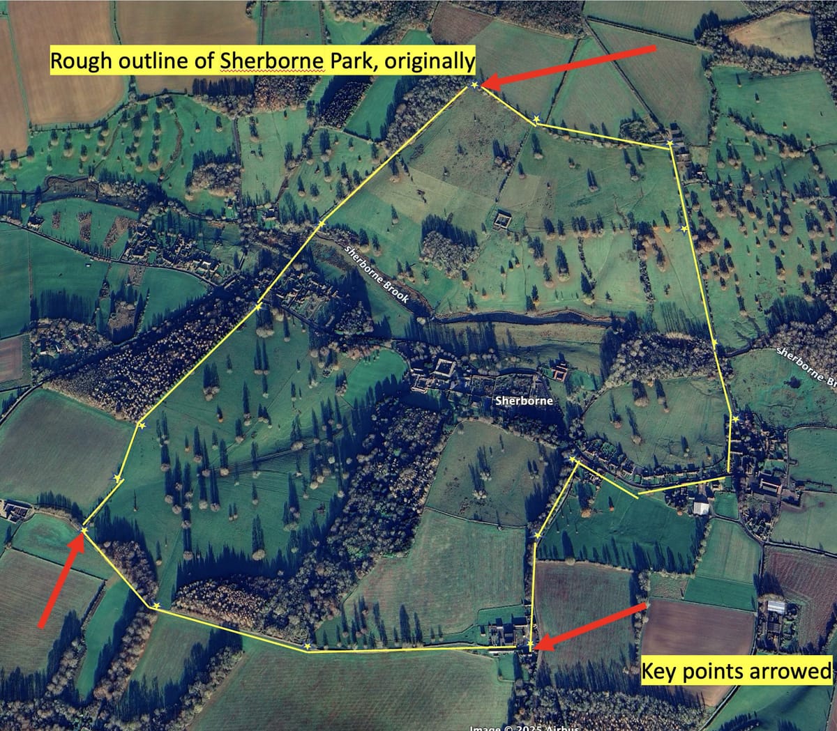
Here’s an aerial photo with what I estimate (roughly) are the original boundaries of Sherborne Park. For this piece of analysis the three points highlighted with red arrows are the key - the two Southern Corners and the Northern Corner:

Next here are lines drawn from the Northern Corner to the two Southern Corners:
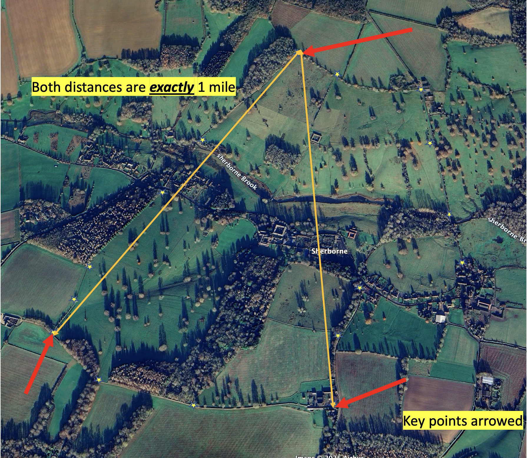
The distances are not “about” a mile. They are exactly 1760 yards, to the inch. That must be beyond coincidence. Curious.
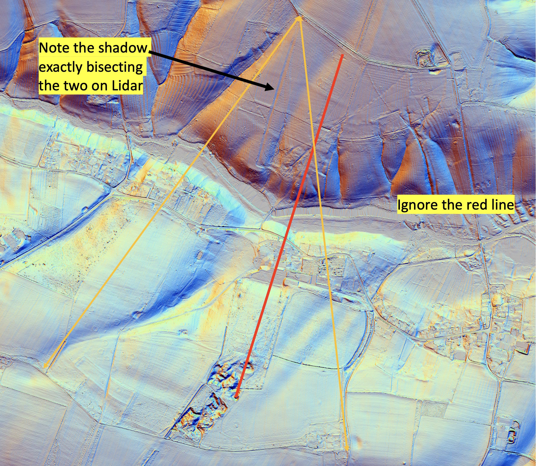
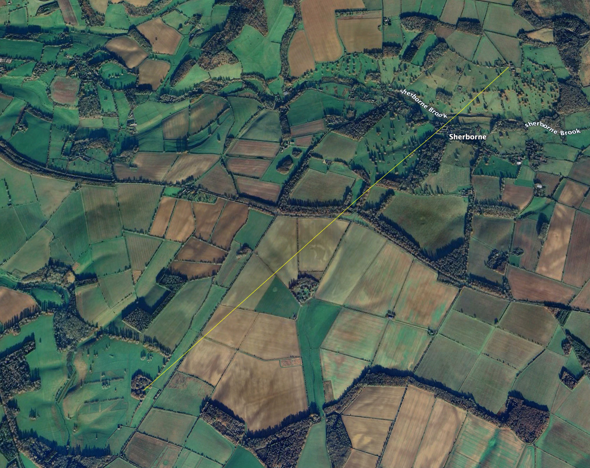
Now when we look at the LIDAR image, something else jumps out. A shadow of a track and a row of trees, no longer visible on the ground but once there, bisects the two 1 mile distances, exactly, 20 degrees either side. Curious. (Give me a little leeway for the graphics I’m using and ignore the red line)
Here’s the bisecting line in black:
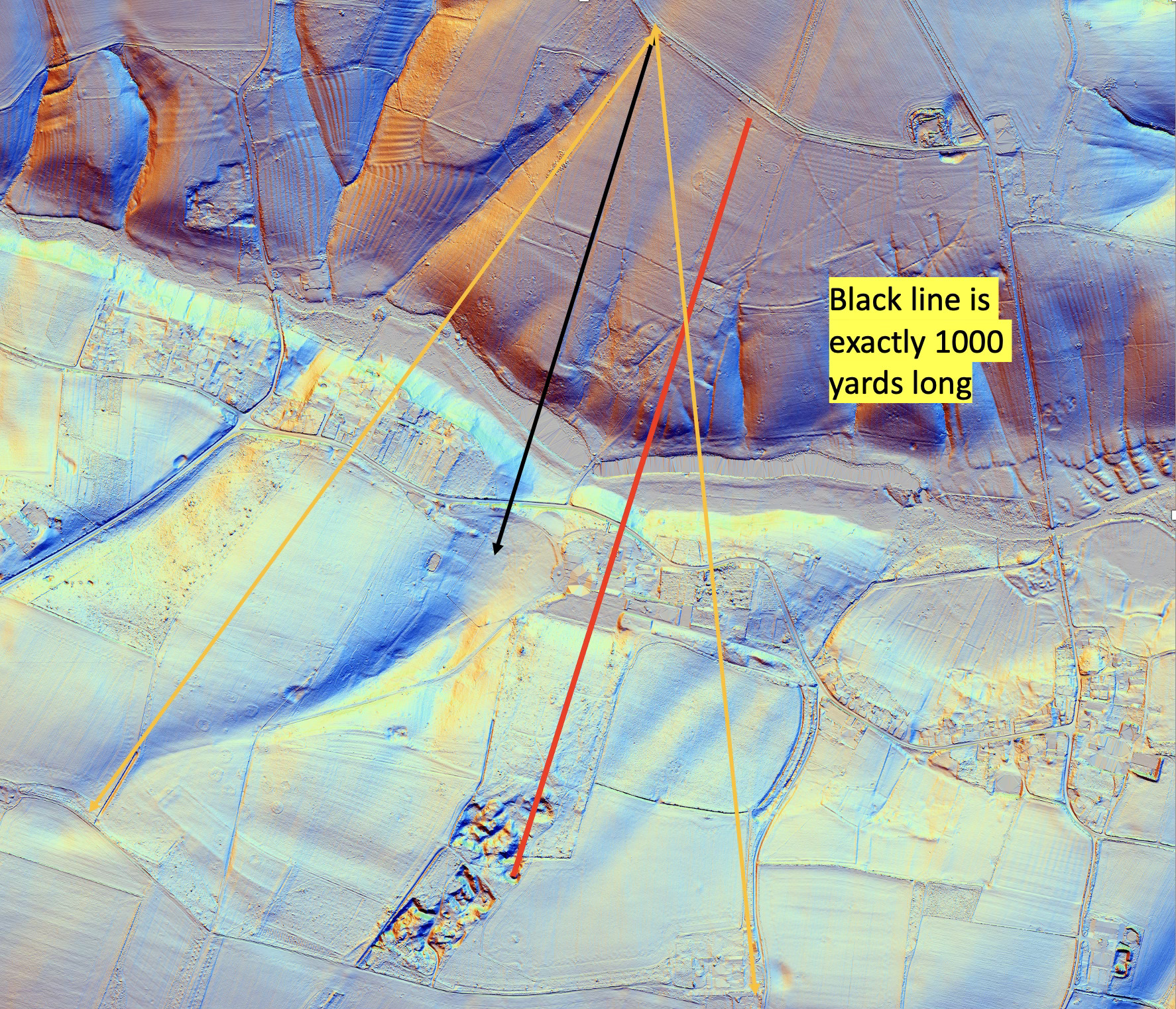
The black line also runs to the curious “Point Zero” on the lawn outside Sherborne House that I identified a couple of years ago (an intersection of interesting lines).
My gut feel that this design happened at the time of Crump Dutton, so maybe 1615- 1630, at about the same time as Lodge Park was being created. A larger deer park previously existed North of the Brook, and this was an enclosure within it. I think…
Another, separate, curiosity - a line from the top North-East Corner of the park by Northfield Barn through the front porch of Sherborne House goes on exactly to the front porch of Lodge Park, thus:
Let me know if you feel we should dismiss these findings as a series of coincidences. They may well be, but it’s worth a hard think.
