Sherborne's Peculiar Alignments
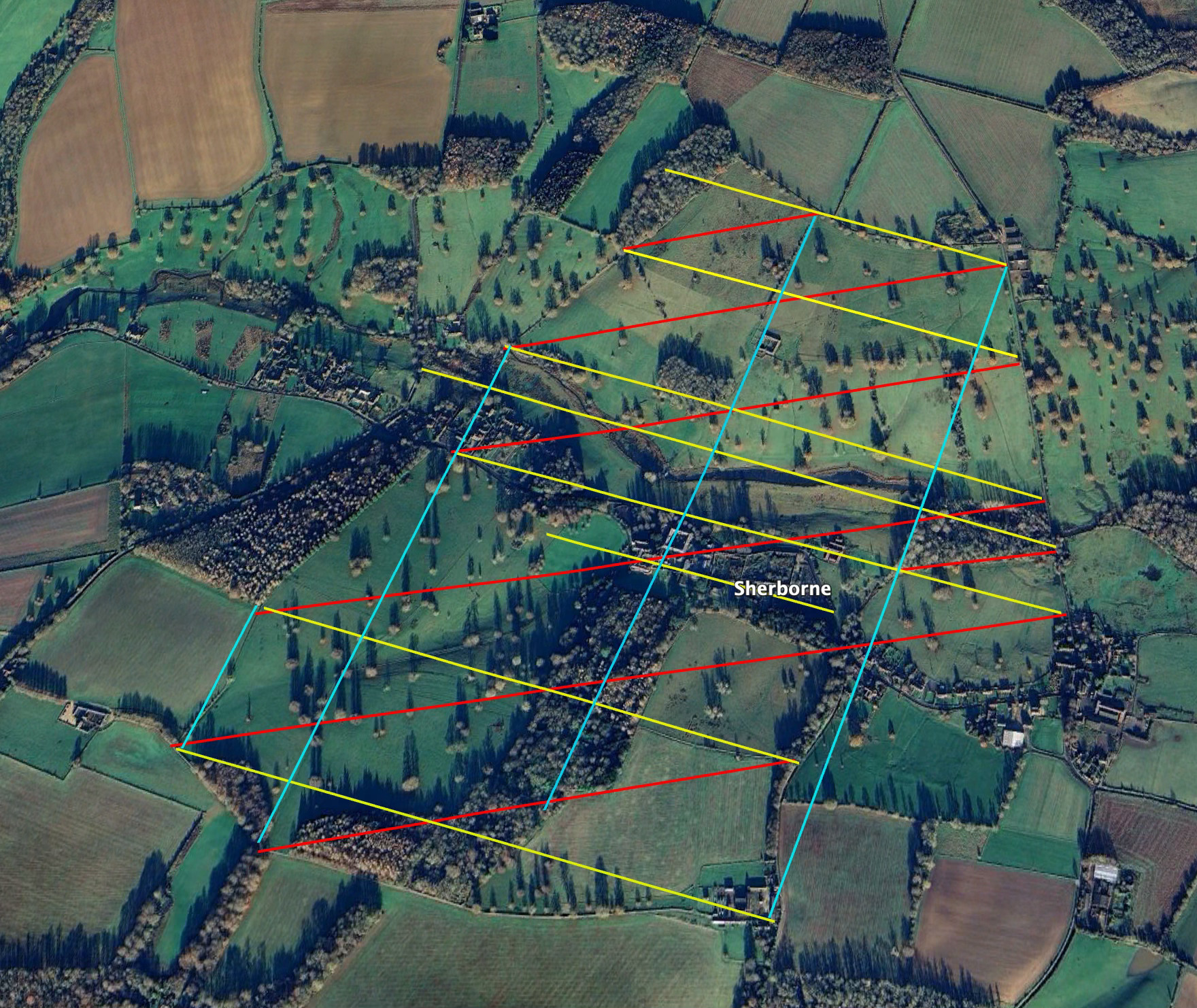
Another set of parallel alignments.

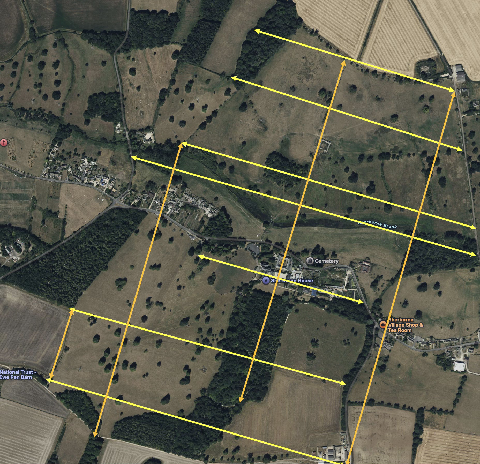
This is a little more of my obsessive map reading about the peculiar lay out of Sherborne’s Parkland. My slightly crude graphics are now being checked carefully with a QGIS, a “proper geo-mapping tool”. More results from there in due course, but as I was uploading the data already found of the perpendicular parallel lines of association between the gates, doors and filed corners around Sherborne Park, yet another set jumped out at me.
These are the lines of association already discovered that I have discussed in earlier posts. At the end of each line is a gate, a door, a stile or a key field corner.
To this, I’ve now spotted these parallel lines of association between the same gates, doors and posts shown below in red. Basically again, a set of parallel associations. Is that coincidence, clever maths or simple maths? You tell me. I have no particular explanation other than someone, three or four hundred years ago, was using a grid system to lay out the estate.
That’s all for now. (but I think there are more!) I’m off to scratch my head and see if these work out on QGIS mapping software.
