The Forgotten Lake: Lodge Park’s Overlooked Second Water Feature
There were two sizeable lakes in Lodge Park, but we can now only see the remains of one.

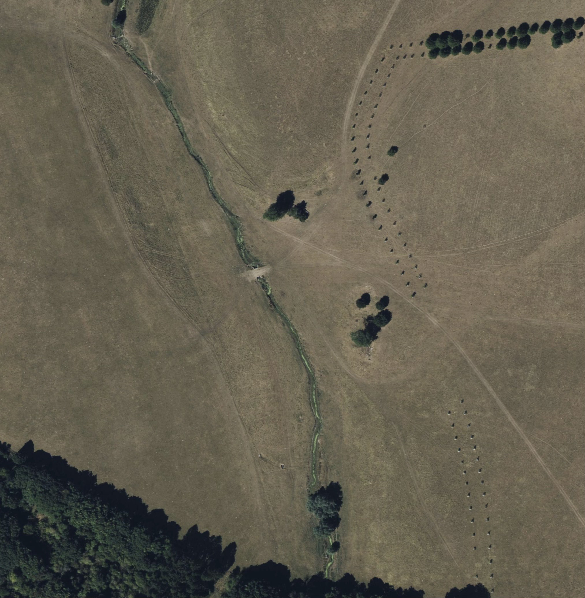
The River Leach flows through Lodge Park’s steep-sided valley. LIDAR reveals a silted canal lake in the valley bottom. This feature appears on Bridgeman’s c.1730 plan beneath his proposed serpentine design, as if the great serpentine is to be laid on top of it - a plan that never left the drawing board.
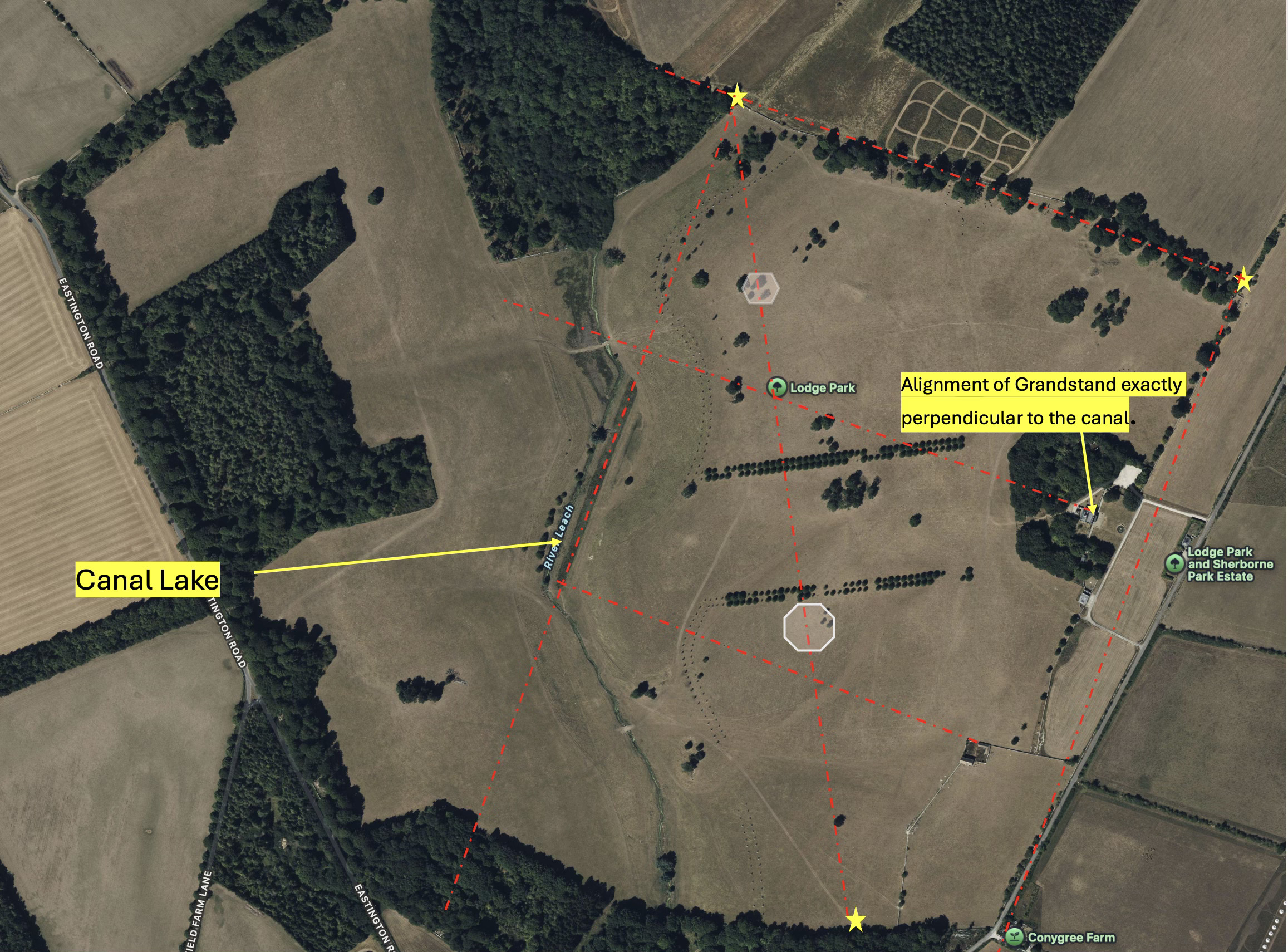
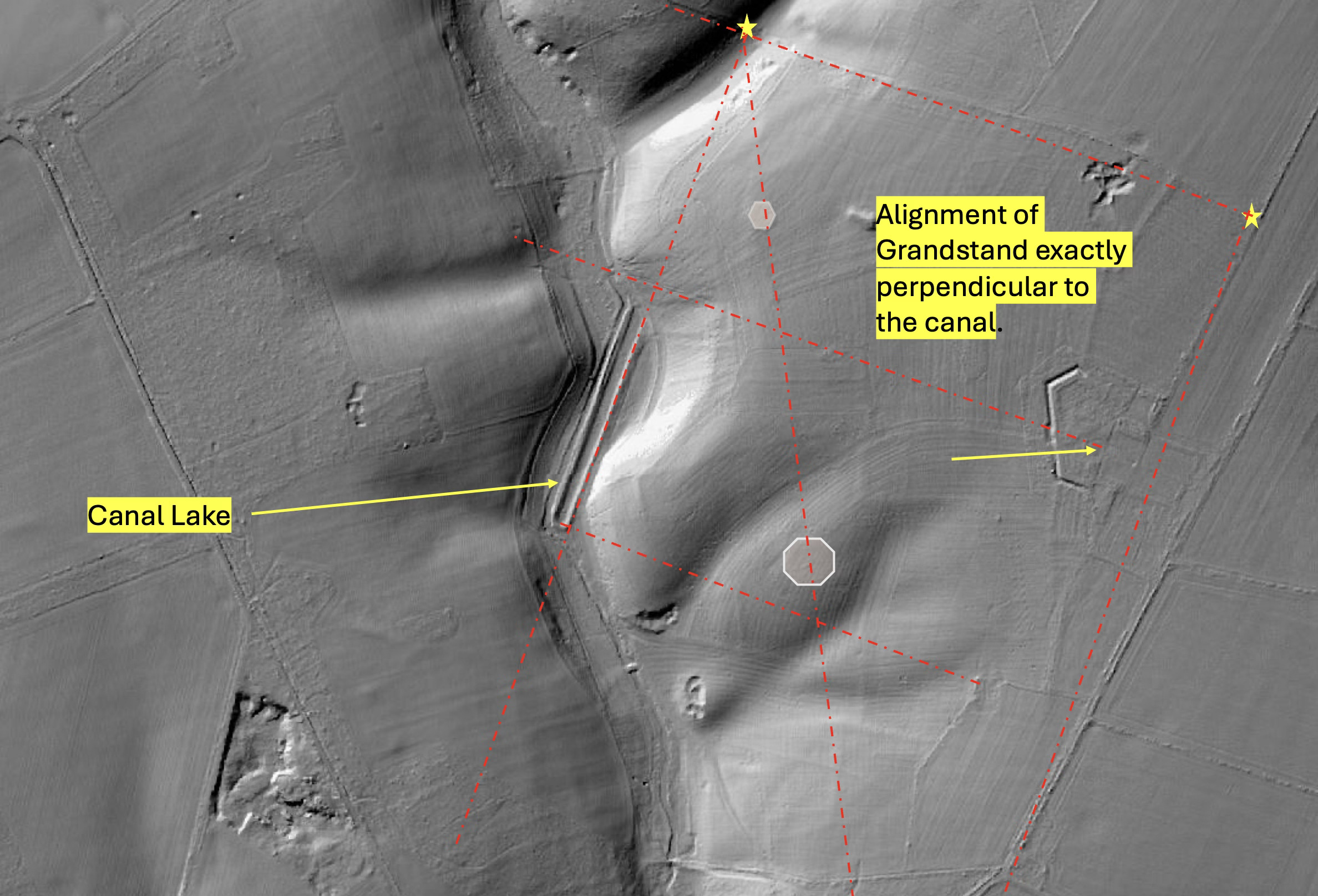
I think it’s VERY important to consider the exact perpendicular alignment of the canal to the alignment of the Lodge park Grandstand. Has this been noticed before, and its parallels alignments elsewhere in the park? Note too, the alignment of the geometric hexagon and octagon which hasn’t been addressed by historians. Scholars consistently credit this “canal-lake” to Bridgeman’s era, but Bridgeman’s alignments are entirely elsewhere and disconnected in some senses with this canal. So I’m not sure that the canal lake can be attributed to Bridgeman as easily as it has been. As I discussed in a post in the summer, estate accounts hint at a different story. Sir John Dutton purchased a rowing boat for Lodge Park in 1725. The first record of Bridgman appearing at Sherborne doesn’t occur till that year. Geological investigations to test a serpentine lake’s feasibility occurred around 1730.
The remains of the canal lake. Dead straight, parallel sides, 300 yards long.
A 1725 wooden boat requires water. The canal lake therefore, I suggest, might predate Bridgeman’s arrival. It certainly predates his rediscovered plan. Its perpendicular alignment with the Grandstand suggests, possibly, much earlier origins.
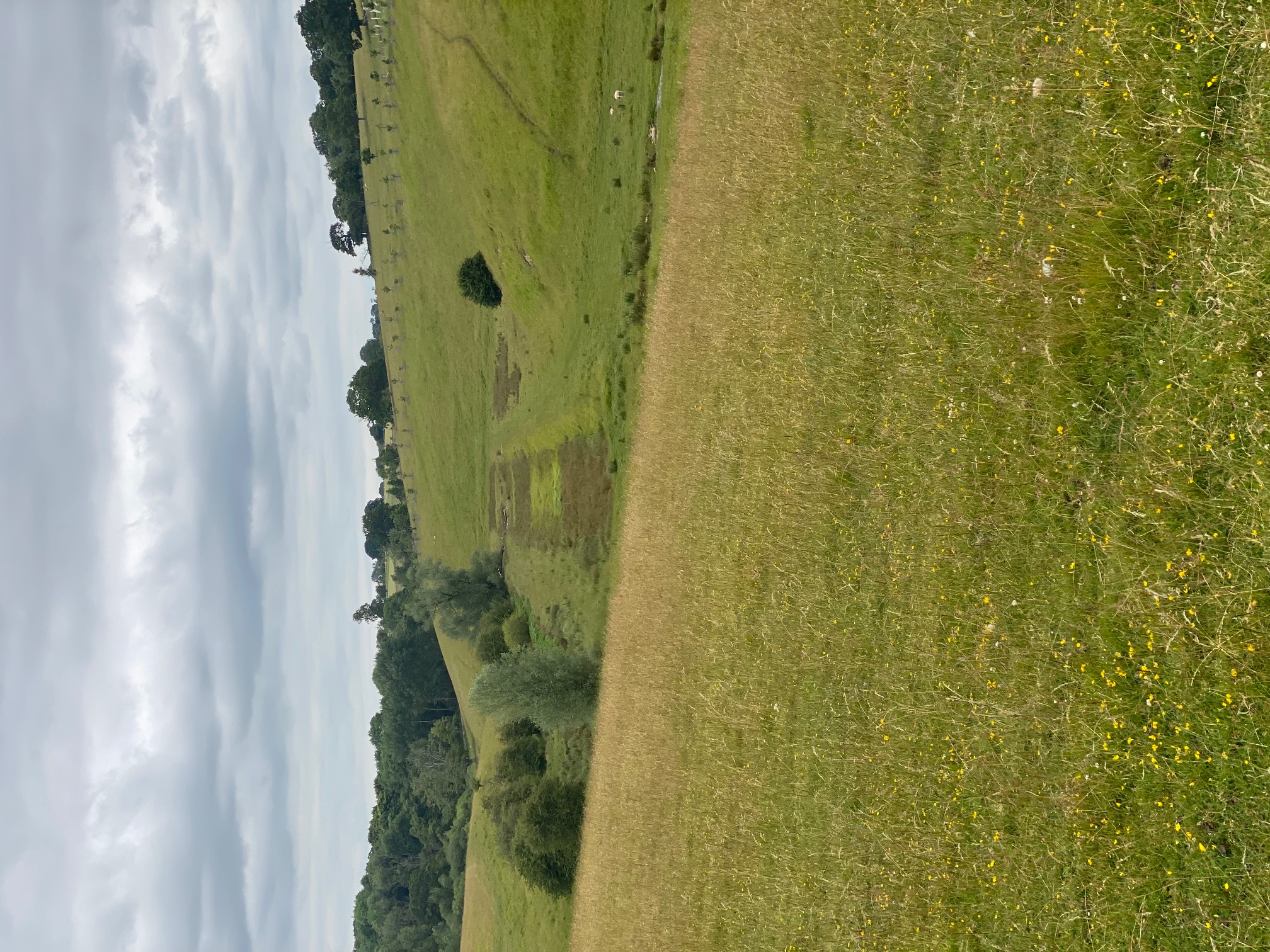
The Lower Lake Nobody Mentions
Bridgeman’s geological survey in 1730 proved his serpentine scheme impossible. Yet scholarly assessments assume he simply abandoned the valley. They miss what happened next.
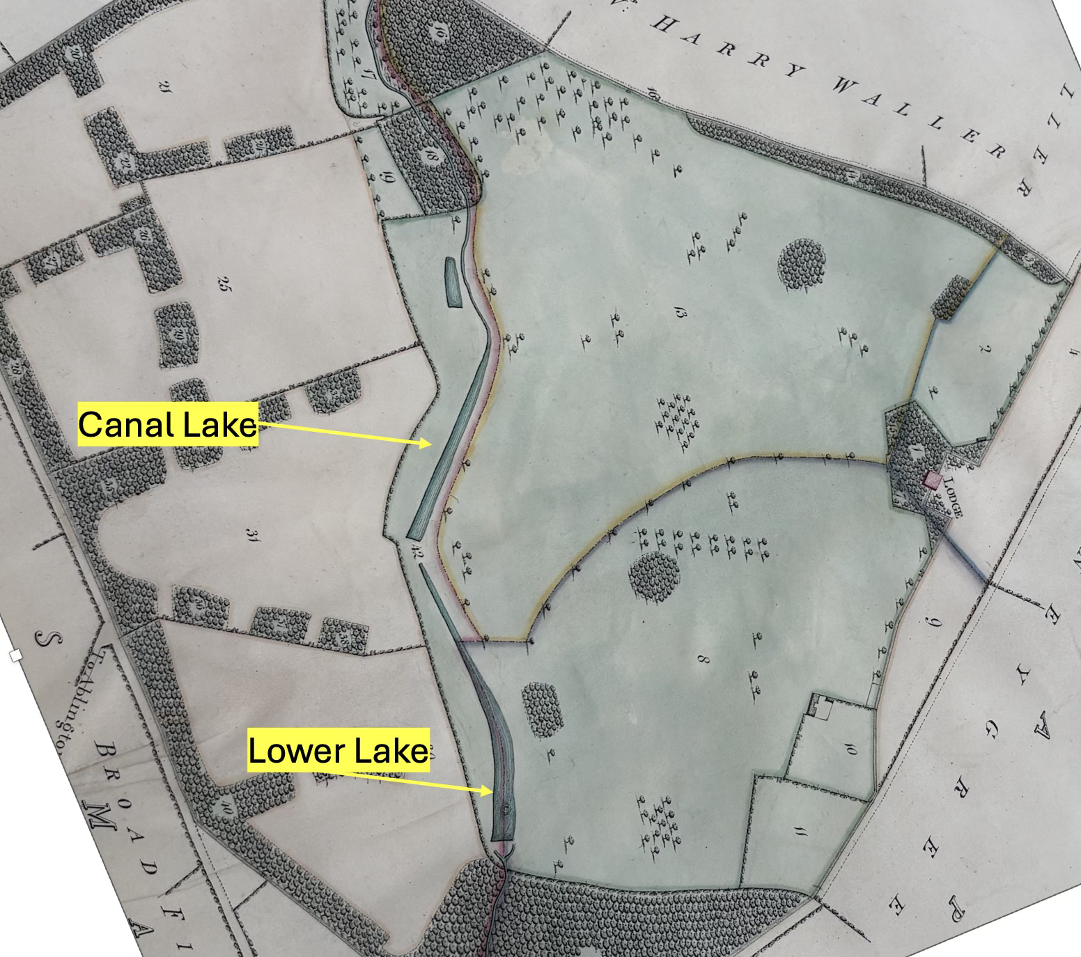
An 1820 estate plan shows a substantial lake downstream. This lower lake featured a central island and paired outflows at its weir. The design mirrors Bridgeman’s cascades at Gobions in Hertfordshire.
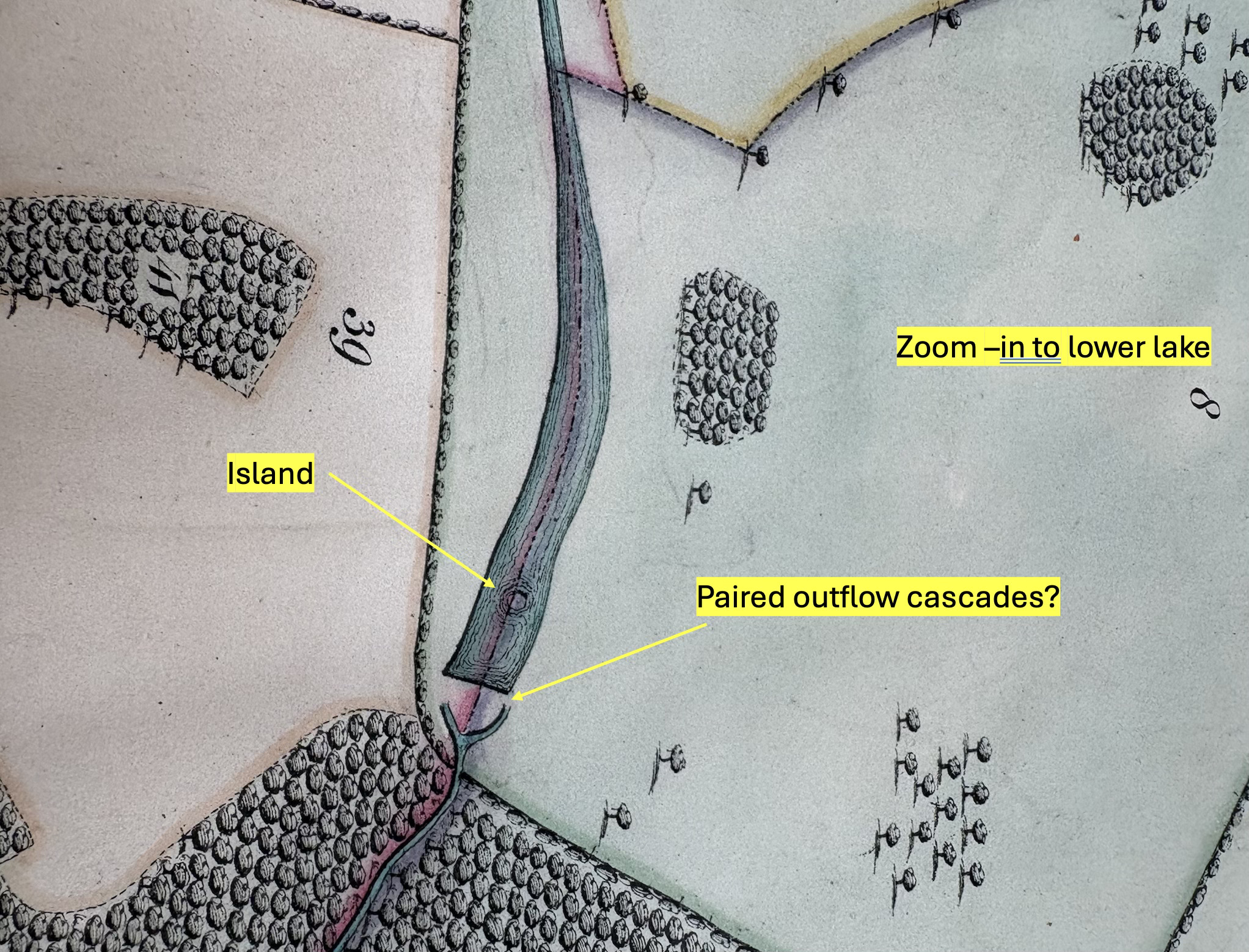
There’s a fascinating article here about the find of an another lost Bridgeman plan in the Bodleian, this time for Gobions. It includes a lake with twin outflows and and island just upstream. A comparison between the two uncompleted plans - for Gobions and for Lodge Park, both by Bridgeman in the 1730s, both lost and found in the Bodleian library, is very worthwhile. I hope there are more lost plans to uncover there.
Estate accounts document considerable construction effort to create the “lower pond” in Lodge Park in 1739/1740. Workers drove piles to stabilize the lower weir. The lake existed throughout the late eighteenth century.
By 1850 it had vanished. Silt claimed the shallow basin. Today almost no trace remains.
I wonder if this lower lake just silted up? Are remnants of the lower weir visible or was it removed? Why is there no mention of it in the official histories? Why hasn’t the alignment of the canal lake been noticed before?
Two Parks, Two Lakes
Sherborne Park sits a few miles away from Lodge Park but part of the same estate. Dutton’s archives suggest parallel projects proceeded simultaneously, with another “new pond” being constructed in Sherborne Park, at the same time (1739/1740). Both estates received lower lakes in exactly the same period. Surely we have to consider Bridgeman for both of them.
This coordinated construction reveals strategic landscape planning across the Sherborne estate. The pattern deserves proper analysis.
Unfinished Business
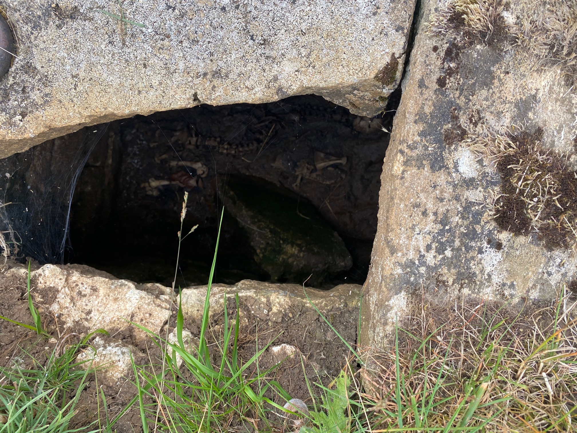
The valley bottom at Lodge Park retains mysterious hydraulic features. Pumps and associated systems survive undated and unexplained. Their purpose and period remain uncertain.
Here’s the masonry cover of an ancient pump system (yes that’s a dead sheep at the bottom)
A full paper in due course will present detailed evidence, including a conjecture that the canal lake may have been created by a gentlemen called Isaac de Caus in about 1630 shortly after Crump Dutton created the parkland. De Caus was also a leading hydraulic engineer at the time, and I’m going to suggest that an investigation of the remains of various strange hydraulic systems in the valley bottom warrant further historical engineering analysis. You’ll have to be patient as I construct this paper. Consider this a taster of something much bigger.
For now, one point stands clear: scholarly literature overlooks the lower lake entirely. Bridgeman’s valley work extended, I think, beyond his failed serpentine scheme. The 1820 plan proves it and is supported by the 1739 estate account describing the creation of a lower lake. In one sense Lodge Park holds too much water body history - a straight, formal canal, an abandoned plan for a huge serpentine lake, and a more “natural” looking chain of lakes in the valley bottom, all three plans present within a few years of each other. A head scratcher.
Lodge Park’s landscape holds more complexity than current interpretations explain. There is also, I think a curious road feature that runs down the middle of the valley, that has some very anomalous characteristics. Watch this space.
