A Bridge over Troubled Tarmac? A wildlife crossing on the A40 at Sherborne
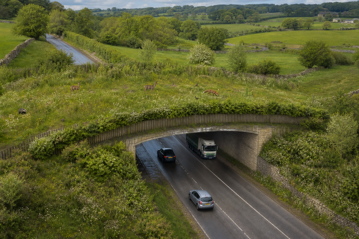
I have picked up in my research some county level strategy development that might, possibly, include some significant and expensive engineering on the A40 here in Sherborne to create a "wildlife bridge".
What is a Local Nature Recovery Strategy?
First, some context. A Local Nature Recovery Strategy is a new kind of plan. The Environment Act 2021 requires one for every area of England. On 13 February 2026, Gloucestershire County Council published the county's first Local Nature Recovery Strategy. It is a bold and coordinated spatial plan, developed with Gloucestershire Local Nature Partnership, with 113 suggested measures to restore nature in Gloucestershire.
One of the suggested measures is a wildlife bridge over the A40 at Sherborne.
Let me be clear about scale. The A40 crossing is one line among 113. It is not the strategy's headline, nor its heart. Most of those measures are sensible, modest, and welcome. This piece is about one, and about how it got there.
I should also declare an interest. Through our Group membership of the Gloucestershire Local Nature Partnership, I knew a strategy was recently published. Even so, it has taken me six months to reach the bottom of it and to an entry tucked away in a technical annex. It certainly wasn't flagged to us by the GLNP as an item of with a detail of a significant feature affecting Sherborne. If an engaged, connected resident who is a member of the GLNP needs half a year to find one line, what chance has everyone else? The aim is sound. The accessibility is not.
Plan overload
This is not the only plan pressing on our patch. We have the Cotswold District Council Local Plan (the infamous EN18). Remember, we only found out about that almost by accident, tucked away deep in a CDC plan. We have the Cotswold National Landscape Management Plan that I circulated last year, where a Bourton councillor was supposedly our representative. We have had, and may still have, the National Trust's ambitious Big Nature and Better Access proposals for Sherborne, which now appear stalled. There is also NT Sherborne Conservation Management Plan (CMP) that has all the appearance of being hidden from us after having been promised years ago. Each runs to hundreds of pages. Each affects the place we live.
Herein lies the problem. Vast effort produces vast documents, too dense for most of us to digest. Some we have no access to. Yet buried within them are decisions that shape our streets, fields, and views. When plans pile upon plans, scrutiny thins. Things slip through unnoticed. The suggested A40 crossing is a case in point.
The line in the appendix
Buried deep in a technical appendix, a short paragraph surfaces the detail. Cotswold District Council endorsed the strategy on 5 March 2026. Few residents will have read the supporting evidence. Fewer still reached page 21 of Technical Appendix A.
There, under Potential Measure 060, "Green Bridges and wildlife crossings", sits this sentence. The strategy maps "a potential 'bridge' on the A40 at Sherborne to promote habitat connectivity."
Note the inverted commas around the word bridge. They are the document's own, not mine. Even the authors seem unsure what they are proposing. A structure? A tunnel? A vague aspiration on a map? The strategy does not say. Nothing appears on the interactive map that is produced to run alongside the strategy.
Who was in the room
The same appendix explains how these crossings were chosen. They were "proposed in partner discussions with Gloucestershire County Council, National Trust and Gloucestershire Wildlife Trust", prompted by requests from National Highways and National Rail.
So the National Trust sat at the table. That is stated plainly in the evidence. The Parish Council, as far as I am aware, did not. I am happy to be corrected if consultation happened and I missed it.
That gap is the point. A landscape intervention on Sherborne's doorstep appears on an official strategy. Yet the community body closest to it seems absent from the discussion that placed it there. For a document that repeatedly praises "community involvement" and "buy-in", that omission jars.
What these crossings cost
Let me be fair to the strategy first. A Local Nature Recovery Strategy maps opportunities. It does not grant planning consent, and it commits no money. Measure 060 is aspiration, not approved action. Nobody is pouring concrete tomorrow. It might be nothing more than someone idly making an ill-thought through suggestion. It might be a high priority ambition. We can’t really tell.
But aspirations have a habit of hardening. Lines on maps become "identified priorities", then feasibility studies, then schemes. This item itself seems to be associated as a priority, depending on your interpretation of some vague language. So the cost question deserves an airing now, not later.
Green bridges are not cheap. The Cockrow Bridge over the A3 in Surrey, opened recently, cost around £3.7 million. That was roughly one percent of a far larger road scheme that carried it. The green bridge on the A417 "Missing Link" at Birdlip forms part of a project costing some £460 million. Those figures matter because context matters. A green bridge is affordable when bolted onto a vast highway upgrade already underway. It is a different proposition as a standalone structure over an existing A road, with no wider works to share the bill. Nobody has published a cost for a Sherborne crossing. Until someone does, the affordability claim is untested.
The value question
I am not against wildlife corridors. Connected habitat helps nature recover, and fragmentation is a genuine problem. On that, the strategy and I agree.
The disagreement or rather, potential disagreement, is about proportion. In a county squeezed by potholes, stretched social care, and creaking drains, a multi-million-pound bridge for badgers and deer is a hard sell. Public money is finite. Every pound has a queue of competing claims. Or is this a part of the National Trust's Big Nature Better Access to allow foot traffic from the Sherborne Park area across all the way to Lodge Park? I don't recall it appearing in the briefing documents the National Trust shared to the Cotswold District Council on the matter
The A40 at Sherborne is a fast, open stretch through land the National Trust already manages. Deer cross it now. The case for spending millions to help them cross more safely would need to be exceptional. I have not seen that case made. I have just seen a phrase in an appendix.
What should happen next
I'm not "knee-jerking" to say no to the concept. I'm knee-jerking to say "oh no it's another opaque plan with no local input." None of this makes the idea wrong. It makes the process incomplete. Three things would help.
First, transparency. The County Council should say plainly what "bridge" means here, and what, if anything, is planned beyond a map. The CDC and NT may wish to comment on their perspective - I think they should. You would think they would have learned from the EN18 fiasco.
Second, consultation. Sherborne Parish Council, and residents, should be asked before this moves an inch further. A strategy built on community buy-in cannot skip the community. It's simply not good enough to have a supposed community strategy but then not involve the local community. The phrase is meaningless without action matching it. If the answer is that this idea is just pie-in-the-sky and the output of blue-sky thinking then I think there's a genuine follow up to ask why are our rates and taxes funding this “strategy” effort when the same county council needs every penny to fix our roads. You may note that in one of the Appendices the County Council discuss a consultation process that has taken place. They report they have consulted 10 people who live in the Cotswolds. That’s pretty shoddy for such a detailed and wide ranging plan, in my opinion. It’s not even lip service.
Third, honesty about cost and potential source of funds. If a scheme ever emerges, its price and its justification should be public from the start. No creeping commitments hidden in technical appendices.
Nature recovery is worth doing well. Doing it well means doing it openly. Doing it perfectly involves we, the community, getting engaged. A crossing that arrives by stealth, or in an opaque package, however green, is the wrong way to build public trust. I'll raise this with the local NT team at their next drop in session whenever that is.
Here's some links for you to make up your own mind:
- GLNP discussion and context
- The strategy document from Glos County Council (several hundred pages in total)
- The technical appendix.(see page 21)
- A screen shot of the mapping of the area around Sherborne:
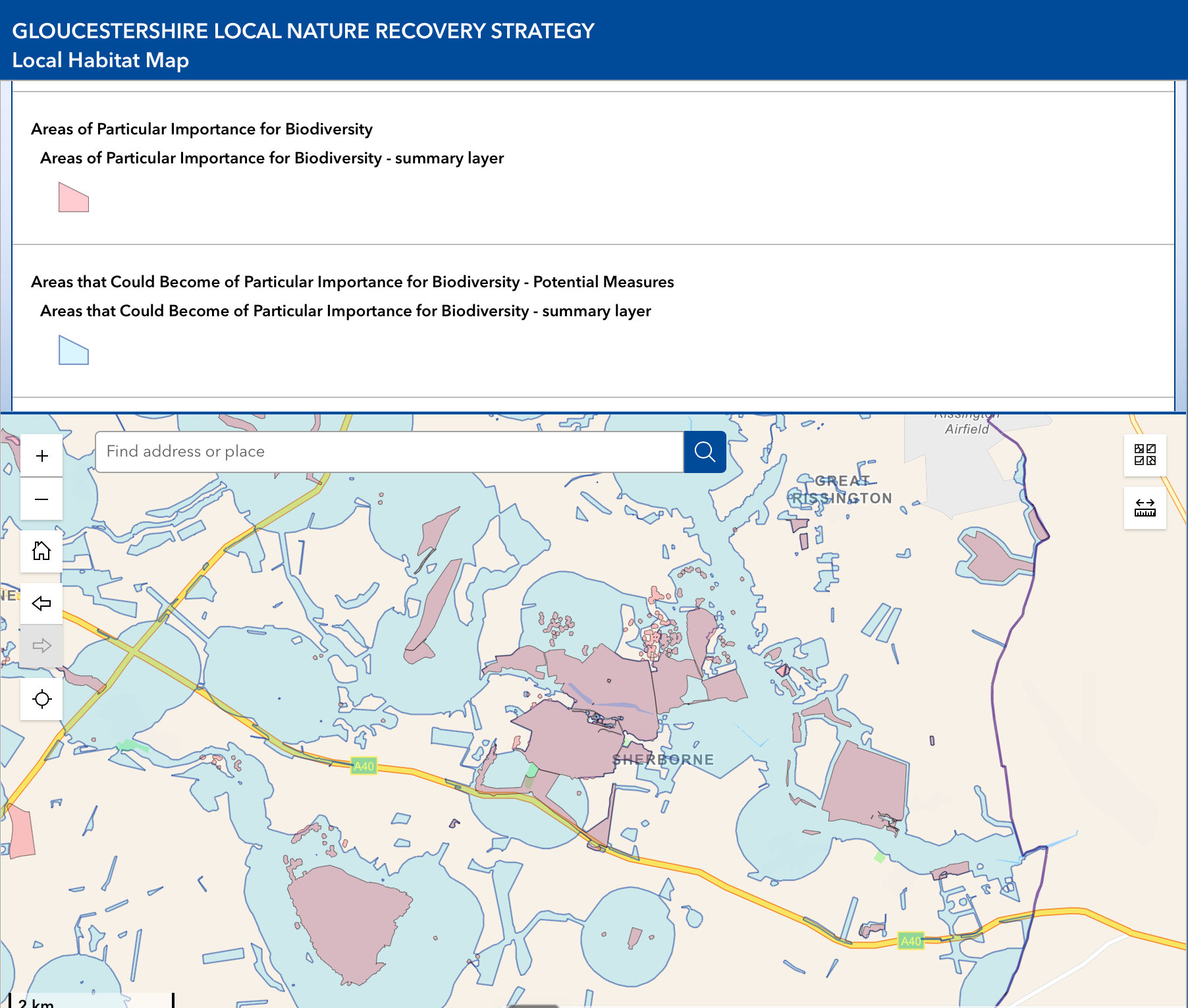
Sources: Gloucestershire Local Nature Recovery Strategy, Technical Appendix A, Measure 060 (published 13 February 2026). Cost comparisons: Cockrow Bridge, A3 Surrey (Natural World Fund / Country Life); A417 Missing Link green bridge (Countryfile).