A Bronze Age Cemetery found
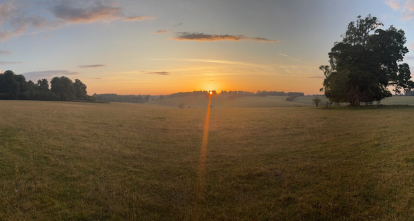
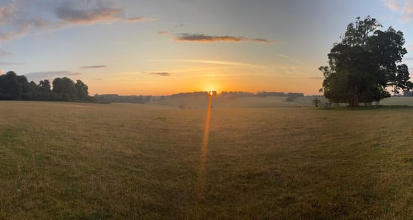
You will know by know I have a little obsession looking for prehistoric burial mounds in the local area. One of the characteristics off these burial sites that I'm trying to nail down is their relationship to water, and this took me a little further away from home territory, looking at the River Leach. I was running what might be crudely termed "algorithms" to compare the Leach with the Sherborne Brook. The Leach runs eastwards from Northleach, through Eastington, then south through Lodge Park. As it heads further south there are some fields that lie to the West of the Leach. See the image below.
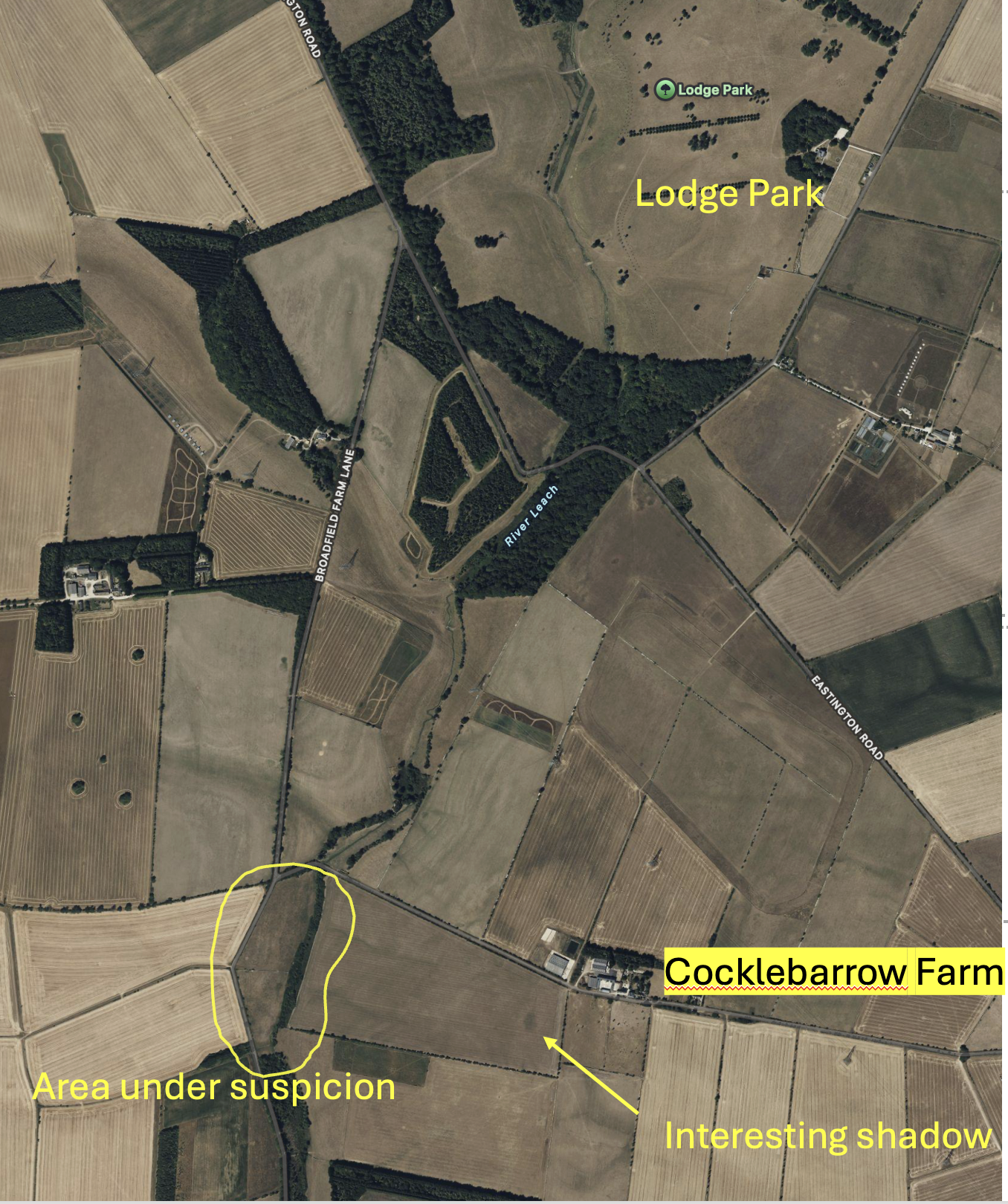
The River Leach runs down the area of suspicion within that band of trees.
These fields seem to have Cocklebarrow Farm on the eastern horizon, looking up. The clue is in the name Cocklebarrow. There must have once been a barrow, a burial mound, near the farm and there is a shaded area that appears to its south on some images, see above. My bet is this was the original "cockle barrow". This barrow (if it is one) would appear prominent on the eastern horizon from the fields in question. So I sniffed about. I looked at LIDAR - nothing . I looked at old maps - nothing. I looked at the Historic Environment Record - nothing ... but wait... a few hundred metres south was a suspected Bronze Age cemetery - some ring ditches (all that remain of Bronze Age round barrows) and maybe even a "henge". I can see no sign but I don't disbelieve the HER. The suggestion is that five suspected round barrows make up what might be classed as "cemetery". But the area I'm looking at is 250m North of there so it's too far away... isn't it?
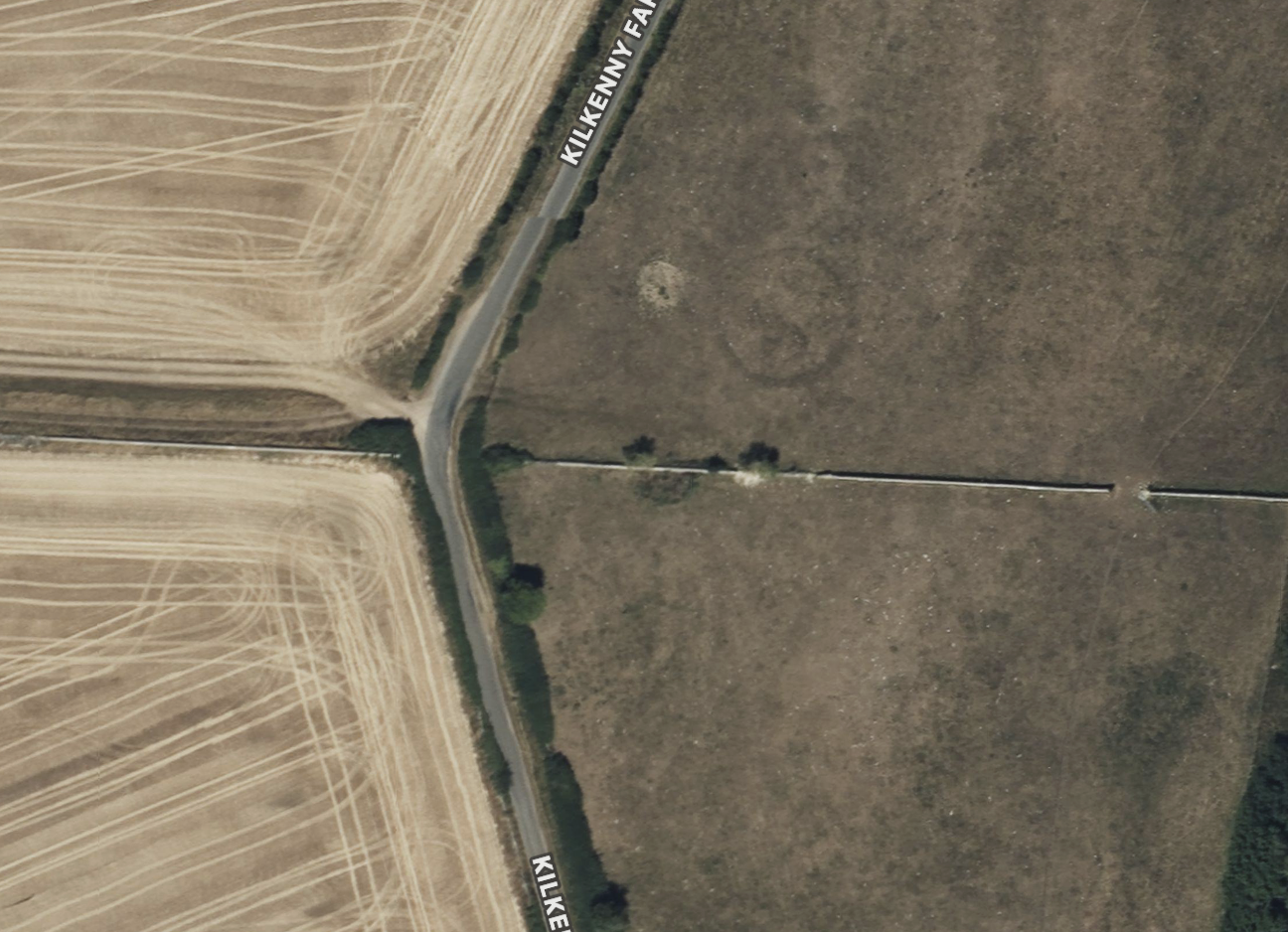
I then went through all the aerial images I could find and in a 2024 image - BINGO. A dark circle, exactly the right size for a Bronze Age ring ditch. Exciting. You can see this perfect circle in the image below.
The understanding is that the round barrows were thrown up as a mound over the buried bronze age body. A ditch from which the mound is made encircles it. These ditches dug into the soil may be ploughed over, the mound itself destroyed over the centuries but a crop mark of the ring ditch remains because of changes to the drainage. They could also be enclosures around a "round house". I pinged the County Archaeologist suggesting this was a ring ditch, and if it was a Bronze Age burial it maybe was either an extension of the cemetery to the south or an outlier. I was suspicious too of some other vague shapes in this particular field, but not enough to be sure.
Tim, the County Archaeologist quickly replied saying he thought I was right. He then checked the aerial imagery he had and came back with this exciting image from 2014, which hasn't been studied before. I've added some crude red arrows.
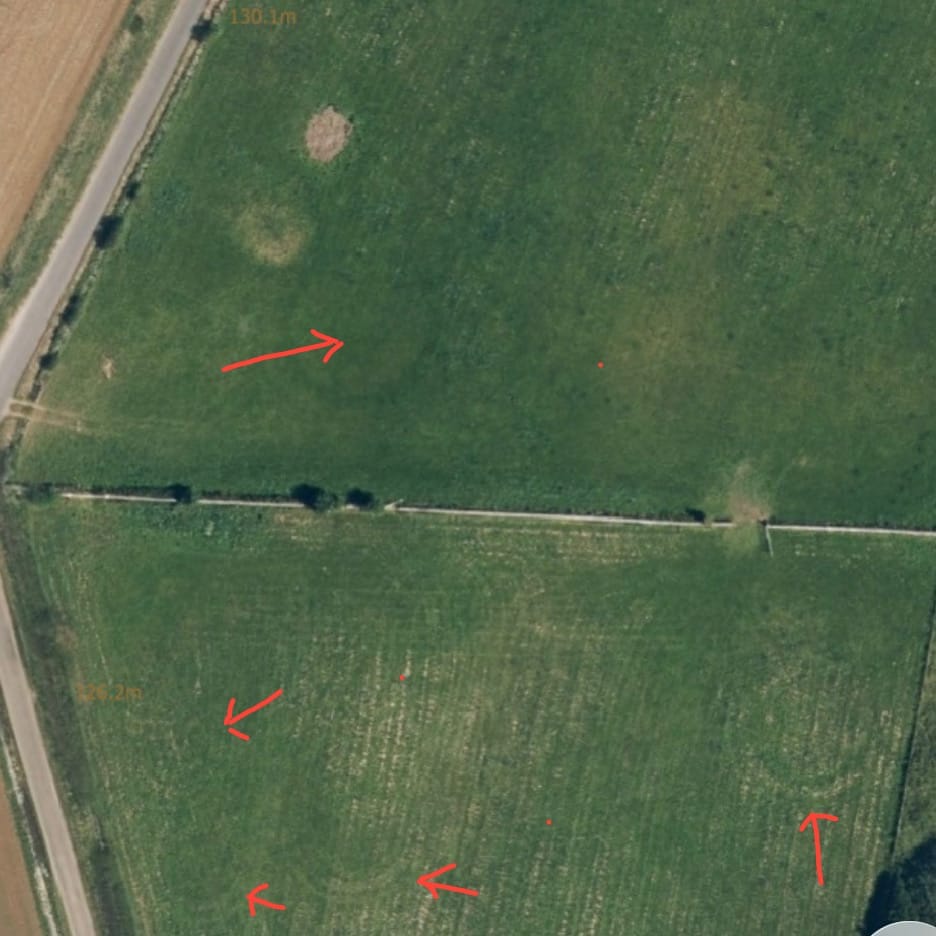
Several comments need to be made:
- There is a hint of an inner ditch or another crop mark within the ring I pointed out. What do you think?
- There's another clear ring ditch on the right hand side.
- Maybe others due south of the one I spotted. If I'm sceptical I can maybe attribute those to tractors turning, but to be honest I think they are prehistoric. Tell me if you agree or not.
- It's interesting how different years and different weather conditions show different features, or none at all.
So we maybe have a remarkable density of bronze age burials here, or it is part of an even bigger cemetery of perhaps dozens of burials if you include the known ring ditches to the south. I think that's exciting. My wife rolls her eyes and you may well too. But it's another jigsaw piece from a couple of miles away which gives us greater understanding of the prehistoric nature of this neck of the woods. In particular it builds our growing understanding of the location of prehistoric sites in relation to rivers and streams and extended views to other prehistoric features on horizons. I'm now going to play this back to look again at the Sherborne Brook in this light.
If you think I'm being over-ambitious, here's a link to some similar Bronze Age cemeteries from elsewhere inn the country. I remain of the opinion that there are a lot more prehistoric sites in this local area around Sherborne, both Neolithic and Bronze Age, than we realise. If you head to Bibury take this route and glance into this field just before you get to Kilkenny Farm. You'll get a feel for this site, its relationship with the river to its side and the horizon on which Cocklebarrow sits. Our Bronze Age predecessors are closer than you think, just the other side of the hedge...