Scotland Hill to Coal-house corner - Sherborne's ancient nomenclature
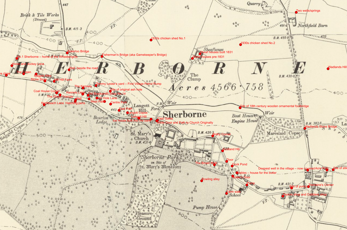
My work with geographic information systems has an interesting spin-off. Above is an annotated map where I've collected place names from a gentleman in the village who's lived here an awful lot longer than I have. Some of the older names of places in the village are shown that we're in danger of losing. I think it's really interesting history.
I regard this as a community resource, so if you know of names of older parts of the village that aren't shown above, please let me know and I will add them to a new version. I can also do this onto a modern map or onto an aerial photograph. If you'd like one for yourself, just let me know and I'll print one off. It's that easy. I can do them at different scales and focus on different parts of the village, or try and squeeze it all in on one. I can filter it by whatever means we want. We might do house names and filter it just for house names, or we might do wells and pumps, because that alone is interesting.
Have a think and tell me of anything else that you know about that needs to go on to a map of the village heritage. I think that's important. I find it interesting. I hope you do too.
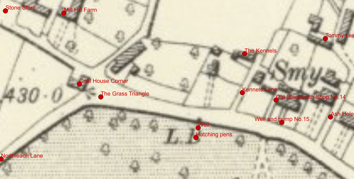
In case the image above is too small, here's a zoom in.